It seems fitting that Pendle Hill should be my first trip report here, since we've seen it so many times from various points of the compass when we've been out walking. It probably seems strange to have left it so long to bag this hill considering it's pretty much on our doorstep but I knew from repute that the vistas from the summit were impressive so I wanted to wait and make sure it was going to be a clear day before heading up there.
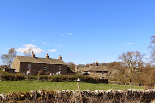
Our starting point was Downham, a charming Lancashire village that was the ideal spot to sample all spring has to offer.
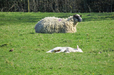
After heading south-east out of the village, and past the increasingly sleepy-looking lambs, we eventually turned to the right leaving the steady gradient of the lane for a steeper line across pasture. This footpath led us to Downham Moor.
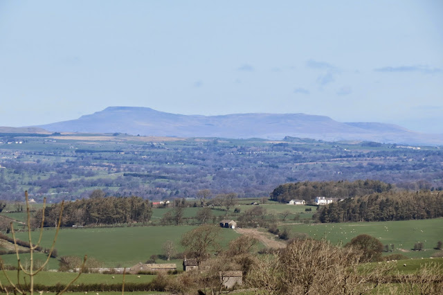
Looking north from this point in the walk, we got some spectacular views across the Ribble Valley, including the distinctive forms of Pen-y-Ghent and Ingleborough.
Once we crossed onto the open access land of Downham Moor the angle of ascent became gentler but curiously we both found it rather tougher going. Perhaps it was because the ground was so wet underfoot, despite this being at the end of a dry spell; there were several large, muddy patches we had to skirt around or gingerly pick our way across and I imagine it would be a bit of a slog after wet weather. Ahead of us, the summit of Pendle Hill looked deceptively modest:
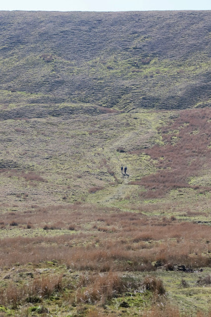
However, zooming in on a couple of walkers ahead of us gave a better sense of its scale:
As it turned out, I actually found the final climb to the summit, steep as it was, easier going than the tramp across the moor. From a distance the slope looked quite unremarkable but close up the ridges of moss took on an almost preternatural glow in the late morning sunlight, as if lit from within. I struggled to get a shot that captured the effect properly but this one, I think, at least gives an idea of it:
When we reached the plateau at the top we were rewarded with some excellent views, including a "ToyTown" perspective on our starting point, Downham.
And the Stansfield Tower on Blacko Hill (to the left of the reservoir below), an architectural folly to pique your curiosity but one which stands on private land where trespassers are not welcome.
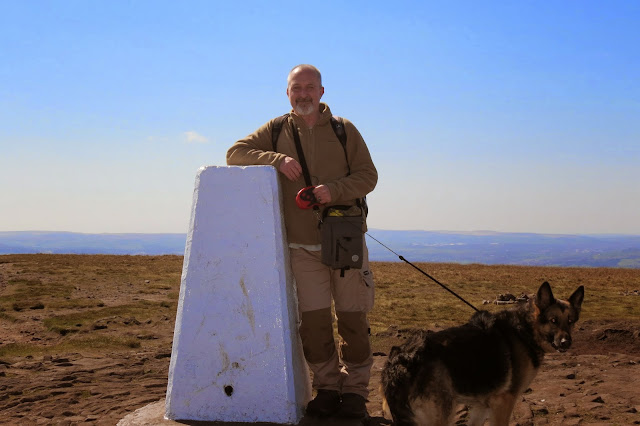
The summit was surprisingly busy, with occasional queues forming for the obligatory trig point photographs - and I dutifully queued myself.
I was quite glad at this point that we had taken the route from Downham up the northern face of the hill as we had encountered barely a handful of people on our way. At times it felt like we had the whole place to ourselves. Clothing aside, it was easy to separate the walkers from the casual visitors - dog walkers, courting couples and boisterous family outings - as the walkers invariably said hello to one another while the remainder steadfastly ignored everyone else around them. I suppose the romantically-paired youngsters can be excused, at least, but it's a shame so many other people up there failed to acknowledge a smile or a greeting.
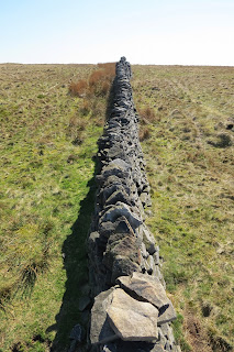
Poses and photos sorted, we headed north, back down from the trig to the wall that forms a spine along the back of the hilltop. We crossed this and struck out along a path in a roughly north west direction.
The summit itself I found rather featureless and uninspiring, though the occasional pool and feathered passer-by added a little interest.
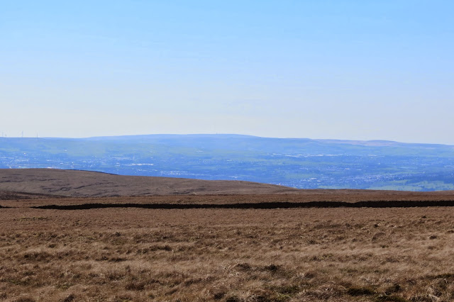
We continued to have excellent views from the summit, however, such as Winter Hill to the south with its transmitting station and mast, one of the tallest structures in Britain and certainly the highest television transmitter in the UK:
And looking north west we had a splendid vista over to the fells of the Forest of Bowland AONB:
Our route was to take us over the satisfyingly high ladder stile, which can be seen pretty much in the middle of the photo above. Always happy to gain a little extra height, I lingered for a few moments before clambering ungracefully down the other side.
Once there, I laid my walking pole aside and braced myself for Rich to pass our German Shepherd, Lotte, over. Although she's never quite mastered standing on the flat top of a ladder stile, she is thankfully sufficiently placid to be lifted into the air and handed over it without batting an eyelid.
She had a rude awakening this time though, as my boot twisted on one of the loose rocks beneath my feet and the two of us went flying - she elegantly transformed the mishap into a cat-like landing, I hit the deck like a sack of spuds.
As I lay contemplating the ground from this novel perspective, Lotte decided to wander off, trying to drag me along after her, and Rich appeared at the top of the stile himself, looking at me quizzically and asking how I was. By this time, although still winded and unable to move, I'd recovered enough to greet his polite vicar-at-a-tea-party enquiries with a tirade of four-letter words. He got this gentle hint remarkably quickly and hurried over to help me up.
After heading south-east out of the village, and past the increasingly sleepy-looking lambs, we eventually turned to the right leaving the steady gradient of the lane for a steeper line across pasture. This footpath led us to Downham Moor.
Looking north from this point in the walk, we got some spectacular views across the Ribble Valley, including the distinctive forms of Pen-y-Ghent and Ingleborough.
 |
| Pen-y-Ghent |
 |
| Ingleborough |
 |
| Downham Moor |
As it turned out, I actually found the final climb to the summit, steep as it was, easier going than the tramp across the moor. From a distance the slope looked quite unremarkable but close up the ridges of moss took on an almost preternatural glow in the late morning sunlight, as if lit from within. I struggled to get a shot that captured the effect properly but this one, I think, at least gives an idea of it:
When we reached the plateau at the top we were rewarded with some excellent views, including a "ToyTown" perspective on our starting point, Downham.
And the Stansfield Tower on Blacko Hill (to the left of the reservoir below), an architectural folly to pique your curiosity but one which stands on private land where trespassers are not welcome.
The summit was surprisingly busy, with occasional queues forming for the obligatory trig point photographs - and I dutifully queued myself.
I was quite glad at this point that we had taken the route from Downham up the northern face of the hill as we had encountered barely a handful of people on our way. At times it felt like we had the whole place to ourselves. Clothing aside, it was easy to separate the walkers from the casual visitors - dog walkers, courting couples and boisterous family outings - as the walkers invariably said hello to one another while the remainder steadfastly ignored everyone else around them. I suppose the romantically-paired youngsters can be excused, at least, but it's a shame so many other people up there failed to acknowledge a smile or a greeting.
Poses and photos sorted, we headed north, back down from the trig to the wall that forms a spine along the back of the hilltop. We crossed this and struck out along a path in a roughly north west direction.
The summit itself I found rather featureless and uninspiring, though the occasional pool and feathered passer-by added a little interest.
And looking north west we had a splendid vista over to the fells of the Forest of Bowland AONB:
 |
| From the stile top. |
Once there, I laid my walking pole aside and braced myself for Rich to pass our German Shepherd, Lotte, over. Although she's never quite mastered standing on the flat top of a ladder stile, she is thankfully sufficiently placid to be lifted into the air and handed over it without batting an eyelid.
She had a rude awakening this time though, as my boot twisted on one of the loose rocks beneath my feet and the two of us went flying - she elegantly transformed the mishap into a cat-like landing, I hit the deck like a sack of spuds.
As I lay contemplating the ground from this novel perspective, Lotte decided to wander off, trying to drag me along after her, and Rich appeared at the top of the stile himself, looking at me quizzically and asking how I was. By this time, although still winded and unable to move, I'd recovered enough to greet his polite vicar-at-a-tea-party enquiries with a tirade of four-letter words. He got this gentle hint remarkably quickly and hurried over to help me up.
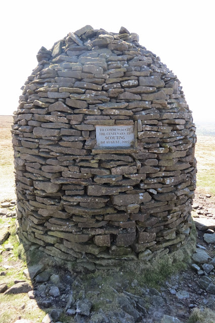
This pleasant interlude over, we decided to stop for lunch at the inviting shelter that lay ahead, here seen with the Scout Cairn on the edge of the hill behind it:
It really was an impressive piece of design and construction, and it provided a welcome respite from the stiff breeze up here that chilled as soon as you stopped moving.
Once we'd filled our bellies, we made for the Scout Cairn - another impressive structure, I might add, and one that marked where we would begin our descent back to Downham.
Ahead was a deep clough in the hillside but our path down lay to the right of the Scout Cairn. I couldn't resist a brief diversion from our route towards this mammoth fold in the flank of Pendle Hill, however.
There were a few cairns on my detour, dotted in what seemed a random manner, and the ground was so rocky underfoot it was difficult to tell if there was any semblance of a trail. I didn't go to the edge of the clough, as it was hard to tell ahead where and when the hillside was going to drop steeply, but my excursion reinforced my feeling that the sides of Pendle Hill were more interesting than its summit.
I traced my steps back to Rich and Lotte and we began a rather steep descent northwards, cutting across the north west flank of the hill as we headed down to Worston Moor. Our route was to take us down to the corner of the walled enclosure here, which we were to follow down to Burst Clough.
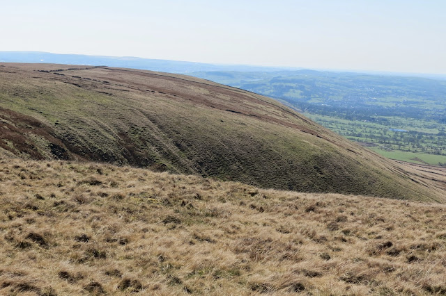
The landscape was fascinating here, with deep grooves and folds worn into the grassland by the streams that flowed from higher up on the hillside.
And we got a good view of Worsaw Hill too, from this angle looking nicely distinct from its surroundings like a proper hill should and worthy of exploration at some point if there is access:
We were intrigued to spot what looked like a cave entrance (in fact, it almost looks like a man-made entrance, given its door-like shape) at the base of the hill but I've not been able to find any information about this online.
Eventually we hit the country lanes and skirted the edge of Worsaw Hill, which looked even more tempting a climb from ground level.
It was a fairly short walk now back to Downham and a relatively flat one too but it was enlivened by the colours of spring in the hedgerows and on the verges of the lane, some of which were carpeted with celandines and studded with daffodils:
The celandines were interspersed with these attractive plants, which seem to be some sort of saxifrage, though I'm not sure which.
It was a nice conclusion to a good afternoon's walking, which we'd both thoroughly enjoyed. It started with all the signs of spring bursting out in a traditional Lancashire village and, after taking in the exhilarating views from the top of an iconic hill, ended in the same way.
The sight of washing on a line in the April sunshine as we entered Downham lent our return a cosy sense of homecoming somehow - an example of how a brief glimpse of something familiar or a long-forgotten smell can trigger strong feelings.
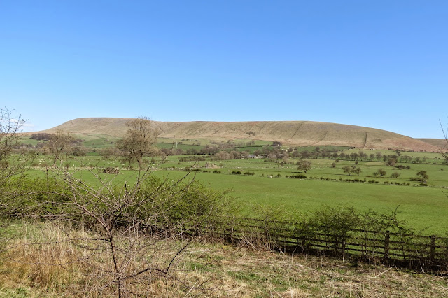
We'd planned on rewarding ourselves with our customary end-of-walk pint of bitter shandy at the Assheton Arms back in the village but unsurprisingly the pub was full, inside and out, so we decided to head straight home. We couldn't resist pulling over for one last photo of Pendle Hill in all its hulking grandeur, though.
Date: April 2015
Walk length: 10.25 km
Total ascent: 468 metres
It really was an impressive piece of design and construction, and it provided a welcome respite from the stiff breeze up here that chilled as soon as you stopped moving.
Once we'd filled our bellies, we made for the Scout Cairn - another impressive structure, I might add, and one that marked where we would begin our descent back to Downham.
There were a few cairns on my detour, dotted in what seemed a random manner, and the ground was so rocky underfoot it was difficult to tell if there was any semblance of a trail. I didn't go to the edge of the clough, as it was hard to tell ahead where and when the hillside was going to drop steeply, but my excursion reinforced my feeling that the sides of Pendle Hill were more interesting than its summit.
I traced my steps back to Rich and Lotte and we began a rather steep descent northwards, cutting across the north west flank of the hill as we headed down to Worston Moor. Our route was to take us down to the corner of the walled enclosure here, which we were to follow down to Burst Clough.
The landscape was fascinating here, with deep grooves and folds worn into the grassland by the streams that flowed from higher up on the hillside.
 |
| Interlocking spurs caused by the action of water. |
And we got a good view of Worsaw Hill too, from this angle looking nicely distinct from its surroundings like a proper hill should and worthy of exploration at some point if there is access:
We were intrigued to spot what looked like a cave entrance (in fact, it almost looks like a man-made entrance, given its door-like shape) at the base of the hill but I've not been able to find any information about this online.
Eventually we hit the country lanes and skirted the edge of Worsaw Hill, which looked even more tempting a climb from ground level.
It was a fairly short walk now back to Downham and a relatively flat one too but it was enlivened by the colours of spring in the hedgerows and on the verges of the lane, some of which were carpeted with celandines and studded with daffodils:
The celandines were interspersed with these attractive plants, which seem to be some sort of saxifrage, though I'm not sure which.
It was a nice conclusion to a good afternoon's walking, which we'd both thoroughly enjoyed. It started with all the signs of spring bursting out in a traditional Lancashire village and, after taking in the exhilarating views from the top of an iconic hill, ended in the same way.
The sight of washing on a line in the April sunshine as we entered Downham lent our return a cosy sense of homecoming somehow - an example of how a brief glimpse of something familiar or a long-forgotten smell can trigger strong feelings.
We'd planned on rewarding ourselves with our customary end-of-walk pint of bitter shandy at the Assheton Arms back in the village but unsurprisingly the pub was full, inside and out, so we decided to head straight home. We couldn't resist pulling over for one last photo of Pendle Hill in all its hulking grandeur, though.
*****
Date: April 2015
Walk length: 10.25 km
Total ascent: 468 metres












0 comments:
Post a Comment