Solo walks are something I've only started doing recently. I don't drive but living in Manchester provides public transport links to a wide variety of great walking country, such as the Peak District, Calderdale and Saddleworth.
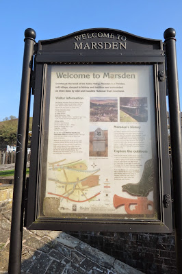
Marsden in West Yorkshire is an attractive village not far from Huddersfield: it's quite large for a village - more of a small mill town really - and its architecture is testament to the area's industrial heritage. It's only half an hour from Manchester Victoria Station if you pick the right train. Some services involve a change in Huddersfield and take twice as long, so it's best to check the Rail Planner site if you're using this method of transport. For those that drive, there is a sizeable car park at the National Trust Marsden Moor Estate Office by the train station.
We'd been to Marsden a couple of times previously, once for a look around the village and on another occasion to walk around Butterley Reservoir. This time, however, I wanted to explore the moorland to the north of the town.
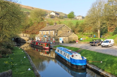
The station sits right by the Huddersfield Narrow Canal and the start of my walk took me along the towpath towards the Standedge Tunnel, the longest canal tunnel in Britain. I'd arrived in Marsden just before 8am and it was a beautifully peaceful spring morning.
I left the canal towpath at Tunnel End - resisting the temptation of the cafe by the entrance to the Standedge Tunnel - and headed right to follow the lane across the head of Tunnel End reservoir to Waters Road. I followed this in a westerly direction until I reached a bridleway on the left.
The bridleway, which followed a pretty brook, was a section of the Standedge Way but I was only on it fairly briefly, until I reached the Close Gate Bridge on the edge of the moor. This is an old packhorse bridge and a grade 2 listed structure. I couldn't find a date for the bridge and possibly it's lost in antiquity but while searching online I did find a fascinating account of the court battle for public access across both the bridge and Close Moss, which took place at the Leeds Winter Assizes in 1908.
On the other side of the bridge there was an inviting path to my left, towards Redbrook Clough, which doesn't seem to be marked on the OS map. I was itching to explore but I had a long walk ahead of me and my journey up onto Close Moss lay to the right and then up Willyhay Clough to the open moor.
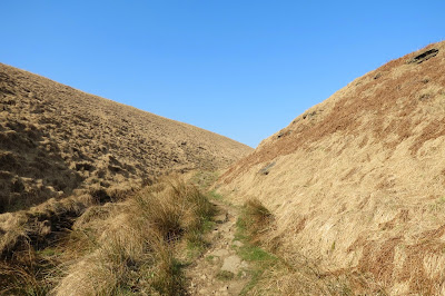
The climb up Willyhay Clough was my first steep ascent of the day and my calf muscles really felt it on the narrow, rocky path. And although it was only around 9am, the sun was really beginning to feel warm so it wasn't long before the fleece came off. I have to admit I made a couple of stops to give my calves a rest but those breaks afforded me some fine views back down the valley.
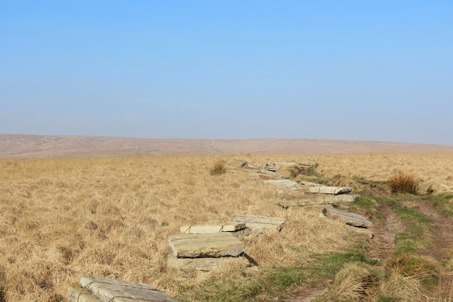
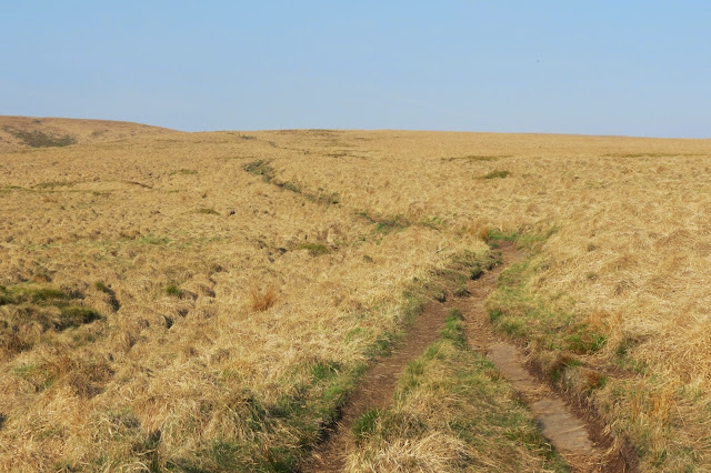
At the top of the clough, the footpath across the moor was in the process of being flagged, although there was nobody around that morning. They certainly had a lot of work ahead of them. Mind you, so did I...
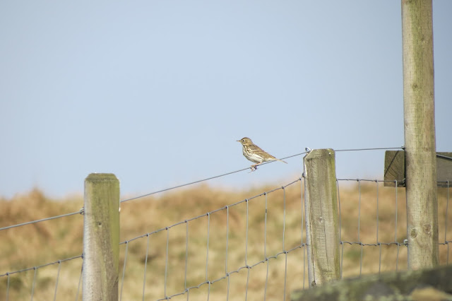
It felt as though I had the whole of the moor to myself, and I probably did. There was non-human companionship in the form of a skylark hovering above me, though, and for a while there was also a large bird of prey in the distance, repeatedly sweeping down low over the grass. It was too fast for me to get a picture try as I might - I wasted a fair amount of battery power in bagging shots of empty blue sky or blurred moorland - so I wasn't able to identify it by zooming in on a photo. It was amazing to watch and when it eventually flew off I wondered if it held some hapless mouse in its talons or if it had missed out on breakfast for now.
My gentle but steady climb across Close Moss eventually brought me to the Huddersfield Road at Haigh Gutter. Here I crossed over and began to follow the Pennine Way towards White Hill. The ascent was quite gentle from here and even the summit of White Hill on the horizon didn't seem that daunting a prospect.
Ahead of me was the first person I had seen since leaving Marsden a couple of hours before (the small white figure on the path in the distance in the picture above). He seemed to have joined the trail from Readycon Dean Reservoir, which sits below here to the left. He was moving at roughly the same pace as I was so our paths didn't cross until later, when he stopped for a lunch break. In the meantime my only company was still of the feathered variety.
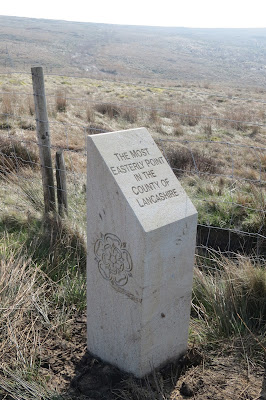
Eventually I left the Marsden Moor Estate and found myself, so the waymarker told me, at the most easterly point of Lancashire.
It was a only short uphill walk to the White Hill trig point now, and once there I took a breather and amused myself with trying to get a selfie with the pillar in the background - not as easy as it sounds with short arms and a 35l rucksack on your back! I've spared readers any of those unflattering shots, though, and contented myself here with one of the trig as I approached it.
From here I carried on along the clear path of the Pennine Way. Ahead of me, the next notable points of the walk were visible in the distance - the Rook Stones Hill transmitter and, behind it, Blackstone Edge. I could hear the murmur of traffic, as regular in its ebb and flow as breakers on a shore line, but for now the motorway lay hidden below the edge of the moor.
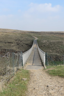
My belly was rumbling at this point even though I'd been consuming Milky Way bars all morning for energy. I'd set myself the goal of reaching Blackstone Edge before stopping for lunch, however, so I pressed on past the transmitter and across the M62 motorway via a slender footbridge.
Not far from the county boundary, the centre of the bridge was a perfect vantage point to look west into Lancashire or east into Yorkshire. It was nice to have a novel perspective too on a motorway along which I've so often travelled in the car, even more so because this location's claim to fame is for being Britain's highest stretch of motorway.
As though it was channelling the spirit of Lewis Carroll, Blackstone Edge didn't seem to be getting any closer for all my walking and I briefly wondered whether heading in the opposite direction might whisk me to the top - well, it worked for Alice on the other side of the looking glass...
From a distance the ground underfoot looked much the same as the moorland I'd traversed so far but, sadly, up close there was a good deal more erosion on this side of the motorway. I was doubly grateful for the paving work that was being done on Close Moss, preserving and restoring this delicate and unique habitat.
The heat and my increasing hunger made the final climb to the gritstone edge a bit of a slog and my sweaty, out-of-breath arrival drew the curious stares of a couple of locals.
It was well worth the effort however and I wasted no time (once I'd eaten) clambering around and exploring the feast of rock formations, sculpted by centuries of exposure to the elements.
Up until now the route had been fairly easy to see, the Pennine Way clearly marked by the passage of boots where it wasn't paved but moving onward from the trig at Blackstone Edge, the rocky ground underfoot made identifying it difficult at times. The trick was to keep heading north and eventually the trail became clearer again. Soon I reached the intriguing Aiggin Stone, the origin of which has been much debated over the years. The consensus now appears to be that it is a medieval waymarker and not of any more antiquated background (though the "Roman Road" marked here on the OS maps is still the subject of debate...)
The Aiggin Stone was my cue to head north west and down from the moor. I took a look back at Blackstone Edge from this point and it was more dramatic from this side than it had seemed from on top. I understood now why it is as popular with climbers as it is with walkers.
In good conditions, the views from up here would clearly be impressive. As it was, the warmth of the day had produced a haze that rendered any interesting long distance photos pretty much out of the question. This was about the best picture I could get of the popular Hollingworth Lake, below me near Littleborough.
I now followed a broad, driveable track down to the Halifax Road. It traced a course alongside a drainage channel and I surmised it was used by the local water authority, a guess which turned out to be correct.
Dawdling and taking photos, and feeling secure of my heading as I was on such a distinct trail, I missed the turn off that led down to the road and ended up at a locked gate, with a "Private" sign on the other side. I must have cut a rather ungainly and noisy figure as I clambered over the clanking metal-barred gate and I was grateful that not too many cars passed by as I performed my acrobatics.
A check of the map showed that I had overshot the exit from the moor by only about 400 metres so I didn't feel too guilty about any inadvertent trespass. And at least it enabled me to get some atmospheric views down into the valley towards Littleborough.
Walking back down the Halifax Road, I rejoined the Pennine Way by the White House Inn, at the head of the massive Blackstone Edge Reservoir. I wonder what - if any - protests there were by locals (or just admirers of the countryside) when all these reservoirs, so typical of Pennine country, were built throughout the nineteenth century and into the early twentieth century? They seem such an established part of the landscape now and I have to confess to finding them quite serene and lovely, especially on a sunny day.
Hot and feeling the strain on my feet though I was, I couldn't resist climbing the bank of the dam to take a look across the waters.
I strolled slowly along the head of the dam, taking in the blue sky reflected in the expanse of water, before rejoining the Pennine Way and heading roughly north again, past Light Hazzles Edge. There were signs here of the area's industrial past.
At this point, for a short while at least, the Pennine Way became conjoined with first the Rochdale Way and then the Todmorden Centenary Way. It runs alongside two reservoirs, the first of which (Light Hazzles) looks almost like a natural water feature on its eastern fringes:
Along with Blackstone Edge Reservoir, Light Hazzles is one of the earliest built in the region and hails from 1798. It's neighbour, the rougher hewn and more capacious Warland Reservoir is thought by some to date from 1827.
My eye was caught by something shining on the horizon as I walked alongside Warland Reservoir, so I took a picture and zoomed in on the image. It turned out to be the whitewashed trig point of the Little Holder stones. With another enticing-looking reservoir above Little Hazzles Edge still to be visited, I marked down this area of moorland for future exploration.
On this day, however, I had to press on and at the top of Warland Reservoir I took a misstep onto the wrong path. Stubbornly, although the evidence of the landscape around me told me otherwise, I persevered for a few hundred metres at least - until the sight of Gaddings Dam convinced me beyond doubt that a sudden turn was never going to have me heading in the right direction. I retraced my steps and rejoined the Pennine Way.
After a little while along this sometimes-flagged section of the trail I found myself nearing Withens Gate, where the Pennine Way and Calderdale Way cross, and now I was on familiar ground. Just by Withens Gate, there was a stone seat where I sat for a while and took in the view. From experience I knew the walk from here to Stoodley Pike was a rollercoaster at times and one that was rock-strewn throughout - by this stage I owed it to my sore feet to give them at least a short respite.
Feet lulled into a false sense of security, I set out for Withens Gate. I don't mind admitting that by this stage, each step was mildly painful to say the least - and the terrain didn't help much.
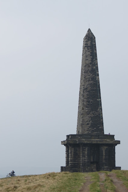
The total walk from Marsden to Hebden Bridge was just under 17 miles - at the time, my longest walk so far. And by this final leg, I'd hit a bit of a wall. Normally an eager photographer, I didn't take many shots towards the end. I was pleased to get one of Stoodley Pike Monument and a motorcyclist, whom I'd seen zipping about in an enviously lively fashion from some distance away.
At the monument, I turned east and headed down to the intersection of the Pennine Way and the Pennine Bridleway near Swillington. From here I followed the lanes in a rough, north-north-easterly direction, turning left after Erringden Grange. I paused here to take a look back up to Stoodley Pike.
From the road, it was now a straight shot across five fields, along a well-trodden and clearly-delineated footpath that keeps to the wall all the way.
Eventually, I arrived at another lane, which I crossed bearing left towards a style in a stone wall. The trees beyond this form Crow Nest Wood and from there it was a steep and muddy descent to the town. The path isn't very distinct at times but you keep heading east and it eventually links up to a clearer, rock-strewn track that runs above and behind houses on the outskirts of Hebden Bridge.
At the end of the path, I bore left in front of the row of houses - there is a railway bridge in plain sight about 30 yards to the left and once under that, the entrance to Hebden Bridge station was on my left. Hot and bothered and footsore, I deemed it too far to walk into the town to the nearest pub for my customary pint of bitter shandy (a difficult decision to have to take!) and waited for the next train home. It had been a good day, with fine spring weather and quite varied scenery albeit a lot of the walk had been on moorland - the moors are, I think, a far more interesting and diverse habitat than they appear from a distance, though they still maintain that awe-inspiring air of bleakness when you're actually standing on them.
I'll leave you with a picture of Hebden Bridge from the farmland I crossed to get to Crow Nest Wood.
Date: April 2015
Walk length: 27 km
Total ascent: 563 metres
Marsden in West Yorkshire is an attractive village not far from Huddersfield: it's quite large for a village - more of a small mill town really - and its architecture is testament to the area's industrial heritage. It's only half an hour from Manchester Victoria Station if you pick the right train. Some services involve a change in Huddersfield and take twice as long, so it's best to check the Rail Planner site if you're using this method of transport. For those that drive, there is a sizeable car park at the National Trust Marsden Moor Estate Office by the train station.
We'd been to Marsden a couple of times previously, once for a look around the village and on another occasion to walk around Butterley Reservoir. This time, however, I wanted to explore the moorland to the north of the town.
The station sits right by the Huddersfield Narrow Canal and the start of my walk took me along the towpath towards the Standedge Tunnel, the longest canal tunnel in Britain. I'd arrived in Marsden just before 8am and it was a beautifully peaceful spring morning.
The bridleway, which followed a pretty brook, was a section of the Standedge Way but I was only on it fairly briefly, until I reached the Close Gate Bridge on the edge of the moor. This is an old packhorse bridge and a grade 2 listed structure. I couldn't find a date for the bridge and possibly it's lost in antiquity but while searching online I did find a fascinating account of the court battle for public access across both the bridge and Close Moss, which took place at the Leeds Winter Assizes in 1908.
 |
| Following the Standege Trail along the brook. |
 |
| Close Gate Bridge |
 |
| The intriguing path to Redbrook Clough. |
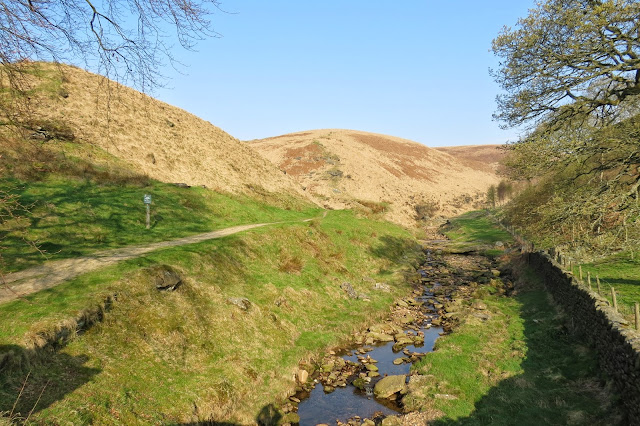 |
| My route up onto the moor is the cleft leading off to the left of the stream |
The climb up Willyhay Clough was my first steep ascent of the day and my calf muscles really felt it on the narrow, rocky path. And although it was only around 9am, the sun was really beginning to feel warm so it wasn't long before the fleece came off. I have to admit I made a couple of stops to give my calves a rest but those breaks afforded me some fine views back down the valley.
At the top of the clough, the footpath across the moor was in the process of being flagged, although there was nobody around that morning. They certainly had a lot of work ahead of them. Mind you, so did I...
It felt as though I had the whole of the moor to myself, and I probably did. There was non-human companionship in the form of a skylark hovering above me, though, and for a while there was also a large bird of prey in the distance, repeatedly sweeping down low over the grass. It was too fast for me to get a picture try as I might - I wasted a fair amount of battery power in bagging shots of empty blue sky or blurred moorland - so I wasn't able to identify it by zooming in on a photo. It was amazing to watch and when it eventually flew off I wondered if it held some hapless mouse in its talons or if it had missed out on breakfast for now.
Ahead of me was the first person I had seen since leaving Marsden a couple of hours before (the small white figure on the path in the distance in the picture above). He seemed to have joined the trail from Readycon Dean Reservoir, which sits below here to the left. He was moving at roughly the same pace as I was so our paths didn't cross until later, when he stopped for a lunch break. In the meantime my only company was still of the feathered variety.
Eventually I left the Marsden Moor Estate and found myself, so the waymarker told me, at the most easterly point of Lancashire.
 |
| The trig at White Hill, 1528 feet (466 metres) above sea level |
It was a only short uphill walk to the White Hill trig point now, and once there I took a breather and amused myself with trying to get a selfie with the pillar in the background - not as easy as it sounds with short arms and a 35l rucksack on your back! I've spared readers any of those unflattering shots, though, and contented myself here with one of the trig as I approached it.
From here I carried on along the clear path of the Pennine Way. Ahead of me, the next notable points of the walk were visible in the distance - the Rook Stones Hill transmitter and, behind it, Blackstone Edge. I could hear the murmur of traffic, as regular in its ebb and flow as breakers on a shore line, but for now the motorway lay hidden below the edge of the moor.
My belly was rumbling at this point even though I'd been consuming Milky Way bars all morning for energy. I'd set myself the goal of reaching Blackstone Edge before stopping for lunch, however, so I pressed on past the transmitter and across the M62 motorway via a slender footbridge.
Not far from the county boundary, the centre of the bridge was a perfect vantage point to look west into Lancashire or east into Yorkshire. It was nice to have a novel perspective too on a motorway along which I've so often travelled in the car, even more so because this location's claim to fame is for being Britain's highest stretch of motorway.
As though it was channelling the spirit of Lewis Carroll, Blackstone Edge didn't seem to be getting any closer for all my walking and I briefly wondered whether heading in the opposite direction might whisk me to the top - well, it worked for Alice on the other side of the looking glass...
From a distance the ground underfoot looked much the same as the moorland I'd traversed so far but, sadly, up close there was a good deal more erosion on this side of the motorway. I was doubly grateful for the paving work that was being done on Close Moss, preserving and restoring this delicate and unique habitat.
The heat and my increasing hunger made the final climb to the gritstone edge a bit of a slog and my sweaty, out-of-breath arrival drew the curious stares of a couple of locals.
It was well worth the effort however and I wasted no time (once I'd eaten) clambering around and exploring the feast of rock formations, sculpted by centuries of exposure to the elements.
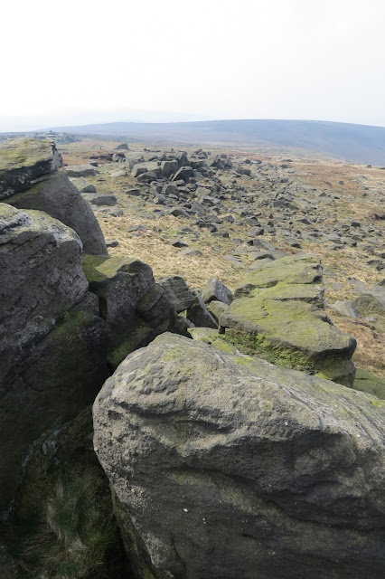 |
| Looking south along Blackstone Edge |
 |
| Looking north along Blackstone Edge |
 |
| The trig at Blackstone Edge, 1549 feet (472 metres) above sea level |
Up until now the route had been fairly easy to see, the Pennine Way clearly marked by the passage of boots where it wasn't paved but moving onward from the trig at Blackstone Edge, the rocky ground underfoot made identifying it difficult at times. The trick was to keep heading north and eventually the trail became clearer again. Soon I reached the intriguing Aiggin Stone, the origin of which has been much debated over the years. The consensus now appears to be that it is a medieval waymarker and not of any more antiquated background (though the "Roman Road" marked here on the OS maps is still the subject of debate...)
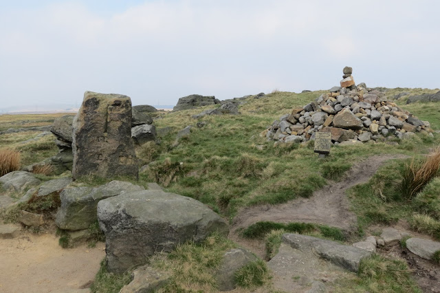 |
| The Aiggin Stone (left) |
The Aiggin Stone was my cue to head north west and down from the moor. I took a look back at Blackstone Edge from this point and it was more dramatic from this side than it had seemed from on top. I understood now why it is as popular with climbers as it is with walkers.
In good conditions, the views from up here would clearly be impressive. As it was, the warmth of the day had produced a haze that rendered any interesting long distance photos pretty much out of the question. This was about the best picture I could get of the popular Hollingworth Lake, below me near Littleborough.
I now followed a broad, driveable track down to the Halifax Road. It traced a course alongside a drainage channel and I surmised it was used by the local water authority, a guess which turned out to be correct.
Dawdling and taking photos, and feeling secure of my heading as I was on such a distinct trail, I missed the turn off that led down to the road and ended up at a locked gate, with a "Private" sign on the other side. I must have cut a rather ungainly and noisy figure as I clambered over the clanking metal-barred gate and I was grateful that not too many cars passed by as I performed my acrobatics.
A check of the map showed that I had overshot the exit from the moor by only about 400 metres so I didn't feel too guilty about any inadvertent trespass. And at least it enabled me to get some atmospheric views down into the valley towards Littleborough.
Walking back down the Halifax Road, I rejoined the Pennine Way by the White House Inn, at the head of the massive Blackstone Edge Reservoir. I wonder what - if any - protests there were by locals (or just admirers of the countryside) when all these reservoirs, so typical of Pennine country, were built throughout the nineteenth century and into the early twentieth century? They seem such an established part of the landscape now and I have to confess to finding them quite serene and lovely, especially on a sunny day.
Hot and feeling the strain on my feet though I was, I couldn't resist climbing the bank of the dam to take a look across the waters.
I strolled slowly along the head of the dam, taking in the blue sky reflected in the expanse of water, before rejoining the Pennine Way and heading roughly north again, past Light Hazzles Edge. There were signs here of the area's industrial past.
 |
| Light Hazzles Edge |
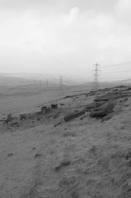 |
| Looking west across to Wicken Lowe |
At this point, for a short while at least, the Pennine Way became conjoined with first the Rochdale Way and then the Todmorden Centenary Way. It runs alongside two reservoirs, the first of which (Light Hazzles) looks almost like a natural water feature on its eastern fringes:
 |
| Light Hazzles Reservoir |
 |
| Light Hazzles Reservoir |
 |
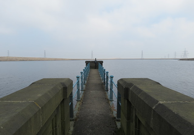
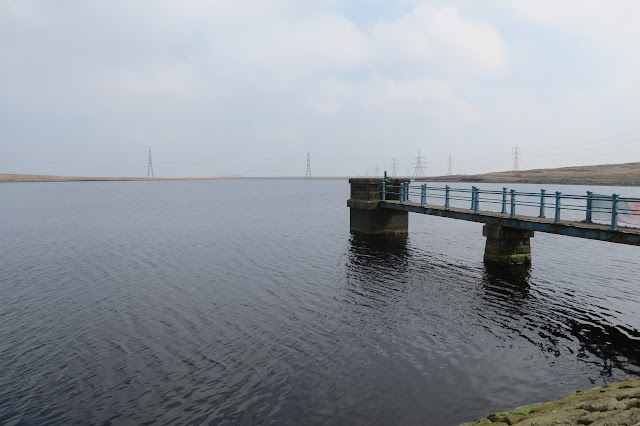
| Outlet tower at Warland Reservoir |
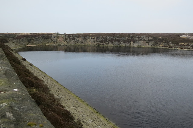 |
| Warland Reservoir |
 |
| The Little Holder Stones on the hill behind Warland Reservoir |
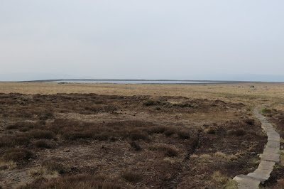 |
| Gaddings Dam lies ahead, my correct route lies behind |
After a little while along this sometimes-flagged section of the trail I found myself nearing Withens Gate, where the Pennine Way and Calderdale Way cross, and now I was on familiar ground. Just by Withens Gate, there was a stone seat where I sat for a while and took in the view. From experience I knew the walk from here to Stoodley Pike was a rollercoaster at times and one that was rock-strewn throughout - by this stage I owed it to my sore feet to give them at least a short respite.
As the dry-stone seat had been built as a memorial to a walker by his children, there was a touch of poignancy to this moment.
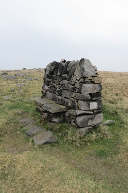 |
| Memorial seat near Withen's Gate |
Feet lulled into a false sense of security, I set out for Withens Gate. I don't mind admitting that by this stage, each step was mildly painful to say the least - and the terrain didn't help much.
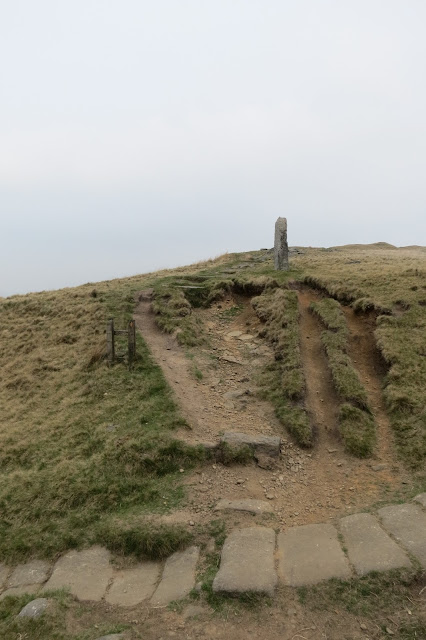 |
| Withens Gate |
 |
| The path ahead... Brace yourself, feet. |
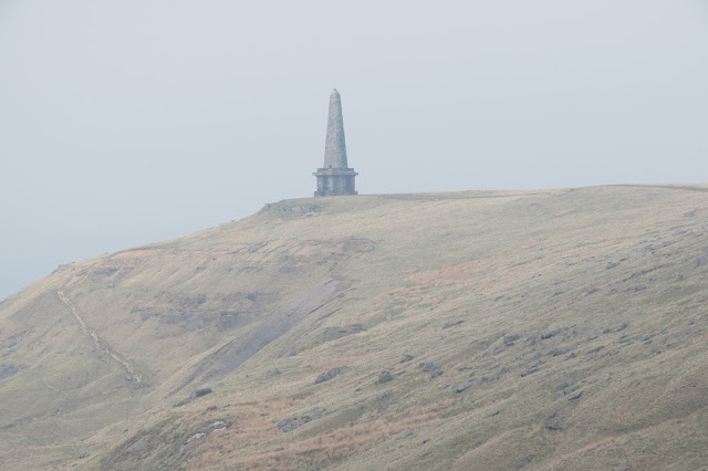 |
| Not quite the end of the walk but something to motivate those aching legs. |
At the monument, I turned east and headed down to the intersection of the Pennine Way and the Pennine Bridleway near Swillington. From here I followed the lanes in a rough, north-north-easterly direction, turning left after Erringden Grange. I paused here to take a look back up to Stoodley Pike.
Eventually, I arrived at another lane, which I crossed bearing left towards a style in a stone wall. The trees beyond this form Crow Nest Wood and from there it was a steep and muddy descent to the town. The path isn't very distinct at times but you keep heading east and it eventually links up to a clearer, rock-strewn track that runs above and behind houses on the outskirts of Hebden Bridge.
At the end of the path, I bore left in front of the row of houses - there is a railway bridge in plain sight about 30 yards to the left and once under that, the entrance to Hebden Bridge station was on my left. Hot and bothered and footsore, I deemed it too far to walk into the town to the nearest pub for my customary pint of bitter shandy (a difficult decision to have to take!) and waited for the next train home. It had been a good day, with fine spring weather and quite varied scenery albeit a lot of the walk had been on moorland - the moors are, I think, a far more interesting and diverse habitat than they appear from a distance, though they still maintain that awe-inspiring air of bleakness when you're actually standing on them.
I'll leave you with a picture of Hebden Bridge from the farmland I crossed to get to Crow Nest Wood.
Date: April 2015
Walk length: 27 km
Total ascent: 563 metres











An excellent account of what looks a cracking walk.Thank you.Looks like you got got the weather,too!
ReplyDeleteI will endeavour to try the walk this year sometime - possibly after a dry spell to avoid any boggy conditions.
Cheers,
Jeff,
Guiseley.
Thanks - I really appreciate your comment.It was a great walk, one I have happy memories of. I hope you enjoy it when you do it yourself.
DeleteAll the best, Justin