 |
| Shelf Moor (l) and Coldharbour Moor (r) in the distance. |
Saturday, 19 December 2015
Thursday, 3 December 2015
Sitting here on the sofa, all wrapped up in a fleece and nursing my man-flu while the November wind and rain batters the house from what sounds like every angle, I've decided to cheer myself up by re-visiting one of the walks I did this past summer. The hills you can see from the A6 between Chapel-en-le-Frith and Manchester had always caught my eye as we drove to and from the Peak District on days out and I decided early in June that it was about time I explored the intriguingly-named Chinley Churn and Mount Famine. The latter's more prosaic sounding companion South Head was also on the list. I'd plotted a circular route from the village of Chinley but just taking in those three summits made for a relatively short walk so I decided to extend my day to take in Brown Knoll which lies just next to the Kinder Plateau.
 |
| Leaving the lane to head up to Cracken Edge. |
Usually, I'll have a gander at Google's street view so I can confidently stride to whichever gate or stile is my entrance to the countryside. On this occasion I'd forgotten to do that so I had to resort to using the GPS file on my phone to guide me through the streets. I pretended I was just intently texting and hoped I didn't look like a complete numpty as I wandered past the locals leaving their homes for work and school.
Thursday, 26 November 2015
 |
| Phone pic of the Howgills from the M6 |
Sunday, 15 November 2015
 |
| Following the Afon Rhaeadr upstream |
Saturday, 10 October 2015
Earlier this year I walked from Glossop to Edale, heading up the Doctors Gate Path and joining the Pennine Way at Snake Pass to make my crossing of the Kinder Plateau. It was to lead me across ground I'd walked many times before on the southern side of Kinder but when I first reached the plateau from Mill Hill and looked eastwards down onto Black Ashop Moor, I realised that in all the times I had climbed this iconic peak I'd never explored its vast northern edge.
A few days after I finished that walk, I sat down to plot myself a route. Not being a driver, I try to keep the Dark Peak reserved for solo walks, as the public transport links from Manchester are pretty decent and I can access the area relatively quickly and easily. My plan was to join the north ridge at its most westerly point, where it juts out quite distinctly above Mill Hill, and head east, following it round until I was above Edale. At the time I assumed I would be tackling this walk in the near future so I decided to avoid repeating the Doctor's Gate Path so soon after I'd just done it and take a different approach to the summit. The Sett Valley Trail seemed to promise an easy warm-up walk from the railway line at New Mills to Hayfield and the Kinder Reservoir.
Well, "best laid plans" and all that... That was last spring - now here we are in autumn and I have finally managed to squeeze this walk in at the end of September. The weather has been unseasonably warm and even though we'd just had a week's leave to go walking and have days out, I decided to take a further last minute day off at the end of my first week back - "easing yourself back into the daily grind after a break", I call it. Or "I can't face a full week in that hellish office" is perhaps another way of phrasing it.
A few days after I finished that walk, I sat down to plot myself a route. Not being a driver, I try to keep the Dark Peak reserved for solo walks, as the public transport links from Manchester are pretty decent and I can access the area relatively quickly and easily. My plan was to join the north ridge at its most westerly point, where it juts out quite distinctly above Mill Hill, and head east, following it round until I was above Edale. At the time I assumed I would be tackling this walk in the near future so I decided to avoid repeating the Doctor's Gate Path so soon after I'd just done it and take a different approach to the summit. The Sett Valley Trail seemed to promise an easy warm-up walk from the railway line at New Mills to Hayfield and the Kinder Reservoir.
 |
| The Torrs Millennium Walkway at the start of my walk. |
Sunday, 20 September 2015
 |
| Garn Ganol, the highest of Yr Eifl's three summits |
Wednesday, 16 September 2015
Part One:
These two jaunts around Rishworth Moor, above Ripponden, started out as a short stroll on the moors for a summer's evening. That had been deliberately planned to come in at around the five mile mark for our elderly German Shepherd, who can't manage the full day walks or stiff climbs any longer. The idea was to head up to Blackwood Edge and follow the old Roman road to the west, with a yomp up to the trig point on Dog Hill, before circling back past Green Withens Reservoir to the car.
 |
| Booth Wood Reservoir. |
Tuesday, 15 September 2015
 |
| The start of the Minffordd Path |
I was itching to get there and for several days had been keeping a close eye on weather forecasts. Various sites, both mountain specific and general, were pretty unequivocal that the outlook was due to be clear blue skies and sunshine towards the end of this week. I needed no second bidding to book a couple of last-minute leave days and we set off to Wales yesterday morning around 6:30am. It was a beautiful morning here in Manchester and in Cheshire too. Luminous mist lying low across the fields and the dazzling sunshine above that made sunglasses a necessity as we drove along the M6 and then the M56. When we hit Denbighshire, however, fog filled many of the valleys and the sunlight made little impact on its grey demeanour.
Wednesday, 9 September 2015
Living in Manchester means that Snowdonia is within just as easy reach for us as the Yorkshire Dales or the Peak District, particularly with the A55 coastal road offering a ready entry into north and central Wales from various points along its course. The Welsh national park is an area we've wanted to explore for a while and the advent of "The Glorious Twelfth" has prompted me to map out a few routes away from the moors during the shooting season. So it was that, with a day of unalloyed sunshine forecast, I settled on the relatively small peak of Moel Siabod as our first Welsh mountain of the season.
We set off early and were lucky to find a space in a lay-by right at the start of our route. We parked next to Llynau Mymbyr. Originally one long lake this is now effectively a pair due to a build-up of sediment in the middle. Looking down from higher altitudes the effect is rather like observing a giant amoeba splitting in two. There remains a passable channel at the moment, it seems, as we later saw canoeists from the Plas y Brenin Mountain Centre at the south western end but no doubt in years to come they will have to carry their boats between the two expanses of water.
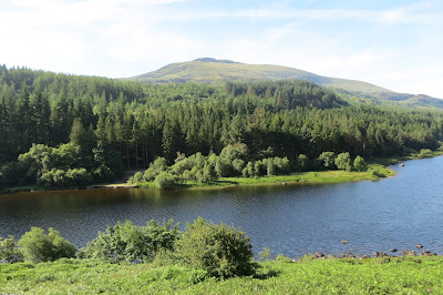 |
| Moel Siabod from Llynau Mymbyr |
Thursday, 30 July 2015
Or, "How Poor Decision Making and Stubbornness Deprived Me of My Beer and Made Me Late for Dinner."
The Dark Peak is famous for its huge grit stone edges, draws for walkers and climbers alike, but few are quite as impressive as Stanage Edge: viewed from its southern end near Upper Burbage Bridge, the six kilometre sweep of millstone grit undulates before you like a breaking wave, permanently suspended above the Hope Valley. From the 458 metre vantage point of High Neb, Win Hill and the peaks of the Great Ridge seem diminished, while the vista over towards Eyam Moor is a gently rolling, pastoral affair; only the dark bulk of the Kinder Plateau beyond them feels like it can match this iconic escarpment in might.My walk was to take in Stanage Edge as its climax but I also wanted to explore Burbage Rocks first, another escarpment that runs south in the form of a broken crescent, from Upper Burbage Bridge to the Longshaw Estate.
Saturday, 18 July 2015
To do the classic horseshoe ridge walk in the Brecon Beacons has long been an ambition of mine so when we booked a few days holiday in Cornwall, a stopover in South Wales on the way seemed the ideal way to realise this.The long range weather forecast had seemed a positive one so we booked into a B&B (the wonderful Mount Pleasant Inn in Merthyr Vale, which thoroughly deserves its numerous five star reviews online) and packed our walking gear alongside our beach and bar wear.
Thus it was we found ourselves parking the car one drizzly morning in the Taf Fechan forest. The fine weather promised had disappeared but the revised forecast of occasional light showers and sunny spells didn't bode too badly. With that in mind, I jammed on my sun hat as well as my waterproof jacket and we set off over the river into the woods.
The walk at this point was a gentle incline but the air was quite close between the trees so it was a relief to come out of the cover of branches and leaves into an area that seemed to have been cleared for timber.
As the woodland thinned we got our first glimpse of the mountain walk ahead of us - the Graig Fan Ddu ridge appeared above the foliage on the left and Craig Cwm Cynwyn became visible on the right. The northern end of the latter, where the summit of Cribyn stands was ominously covered in clag.
The terrain was surprisingly boggy here, and the slippery, thin logs placed hither and thither along the footpath made crossing the wettest sections a tricky balancing act. As we approached the dam of the Lower Neuadd Reservoir, the ground grew more reliable under our feet and it became safer to look around as you walked instead of constantly looking down to assess the solidity of the earth.
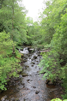 |
| The Taf Fechan |
The walk at this point was a gentle incline but the air was quite close between the trees so it was a relief to come out of the cover of branches and leaves into an area that seemed to have been cleared for timber.
As the woodland thinned we got our first glimpse of the mountain walk ahead of us - the Graig Fan Ddu ridge appeared above the foliage on the left and Craig Cwm Cynwyn became visible on the right. The northern end of the latter, where the summit of Cribyn stands was ominously covered in clag.
The terrain was surprisingly boggy here, and the slippery, thin logs placed hither and thither along the footpath made crossing the wettest sections a tricky balancing act. As we approached the dam of the Lower Neuadd Reservoir, the ground grew more reliable under our feet and it became safer to look around as you walked instead of constantly looking down to assess the solidity of the earth.
Saturday, 11 July 2015
Thor's Cave above the Manifold Valley has long been on my list of places to visit and at the end of June we drove out late one Sunday afternoon to explore this area of the White Peak. Along the lower reaches of the valley itself runs the Manifold Way, from Hulme End to Waterhouses: this was once the route of the relatively short-lived Leek and Manifold Valley Light Railway (L&MVLR), which maintained a economically-precarious existence from 1904 to 1934 before finally giving up the ghost. The Wiki entry on the Manifold Way mentions a wag among the railway workers on the line describing it as a "line that started in the middle of nowhere, and ended up in the same place", and his quip succinctly explains its demise.
Our walk started at the northern end of the trail at Hulme End. The station at the head of the railway line once stood here and there is a pay-and-display car park, public toilets and a visitor centre. It was fairly late in the afternoon when we started out but the weather was glorious and the sunset wasn't due until after 9.30 so we relished the thought of a walk into the early evening. As we followed the tarmac path (the trail has good accessibility for pushchairs and wheelchairs though occasionally shares a route with motor traffic), Ecton Hill appeared to our left. I'd mentioned to Rich that there was a hill at the end of the route but when it suddenly loomed into view I prudently decided to keep quiet for now that this was it.
Our walk started at the northern end of the trail at Hulme End. The station at the head of the railway line once stood here and there is a pay-and-display car park, public toilets and a visitor centre. It was fairly late in the afternoon when we started out but the weather was glorious and the sunset wasn't due until after 9.30 so we relished the thought of a walk into the early evening. As we followed the tarmac path (the trail has good accessibility for pushchairs and wheelchairs though occasionally shares a route with motor traffic), Ecton Hill appeared to our left. I'd mentioned to Rich that there was a hill at the end of the route but when it suddenly loomed into view I prudently decided to keep quiet for now that this was it.
 |
| Ecton Hill |
Friday, 26 June 2015
The Dark Peak is justly famous for its heather and peat-blanketed uplands and the dark gritstone edges, scoured by centuries of wind and rain, that gaze menacingly down on its vast reservoirs - this is many people's first image when someone says they're going walking in the Peak District and it's probably usually mine too. It's not the whole story though, as picturesque towns like Bakewell and Matlock bear witness, and the fertile farmland in which they lie contains some real hidden gems for the hiker.
We ventured back into this territory late last year, when we had a friend staying with us who was temporarily using a wheelchair. A search for accessible outdoor locations led us to Tideswell Dale and we made a note to return and explore the area further.
That short outing brought us, albeit much later than we planned, to Cressbrook Dale last month. We left the car at a free roadside parking spot by the River Wye on the lane between Monsal Head and Cressbrook village.
Monday, 15 June 2015
Like our excursion to Knott End-on-Sea recently, Catlow Hill was another short walk that was planned at the last minute. The choice of location actually came from that afternoon out, inspired by the views we had seen inland, as we wandered round the lanes and salt marshes of coastal Lancashire. It was the first time either of us had been to the Forest of Bowland AONB and I really was blown away by the scenery, with huge expanses of moorland (just my type of walking country) rising up all around us.
It was far more breathtaking than the photo above suggests and I could have stood by the roadside for ages, gazing at the fells. Once I'd got back into the car, we drove on, passing through the attractive village of Slaidburn, until we reached the Cross of Greet Bridge car park, by the River Hodder.
 |
| The Forest of Bowland |
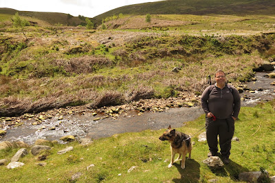 |
| Lotte and Rich by the River Hoddder |
Friday, 5 June 2015
This was an impromptu short walk we did a couple of weekends ago when the weather one Sunday afternoon defied the forecasters and brightened up. Although I have a store of walks saved with OS Maps, none of them were short enough for the time we had left in the day nor did I have time to sit and work a new one out. So I turned to the AA for this route.
We parked up in a large car park by the golf club, which provided views across the mouth of the River Wyre towards Fleetwood, where old and new were juxtaposed.
Mind you, our carpark had an air of history about it that afternoon too.
We parked up in a large car park by the golf club, which provided views across the mouth of the River Wyre towards Fleetwood, where old and new were juxtaposed.
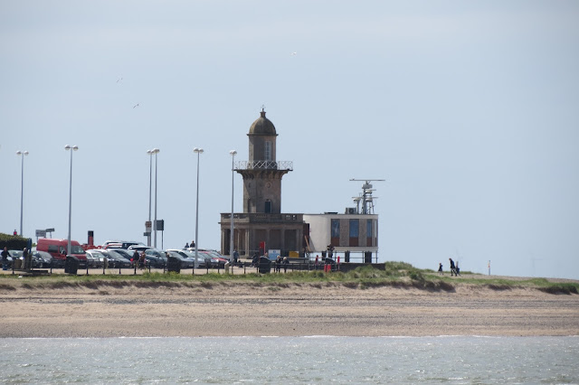 |
| The Beach Lighthouse and the radar station at Fleetwood. |
Sunday, 31 May 2015
Solo walks are something I've only started doing recently. I don't drive but living in Manchester provides public transport links to a wide variety of great walking country, such as the Peak District, Calderdale and Saddleworth.
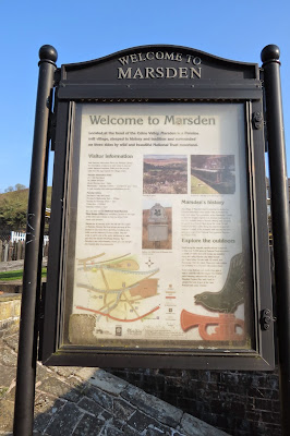
Marsden in West Yorkshire is an attractive village not far from Huddersfield: it's quite large for a village - more of a small mill town really - and its architecture is testament to the area's industrial heritage. It's only half an hour from Manchester Victoria Station if you pick the right train. Some services involve a change in Huddersfield and take twice as long, so it's best to check the Rail Planner site if you're using this method of transport. For those that drive, there is a sizeable car park at the National Trust Marsden Moor Estate Office by the train station.
We'd been to Marsden a couple of times previously, once for a look around the village and on another occasion to walk around Butterley Reservoir. This time, however, I wanted to explore the moorland to the north of the town.
Saturday, 9 May 2015
It seems fitting that Pendle Hill should be my first trip report here, since we've seen it so many times from various points of the compass when we've been out walking. It probably seems strange to have left it so long to bag this hill considering it's pretty much on our doorstep but I knew from repute that the vistas from the summit were impressive so I wanted to wait and make sure it was going to be a clear day before heading up there.


