This was an impromptu short walk we did a couple of weekends ago when the weather one Sunday afternoon defied the forecasters and brightened up. Although I have a store of walks saved with OS Maps, none of them were short enough for the time we had left in the day nor did I have time to sit and work a new one out. So I turned to the AA for this route.
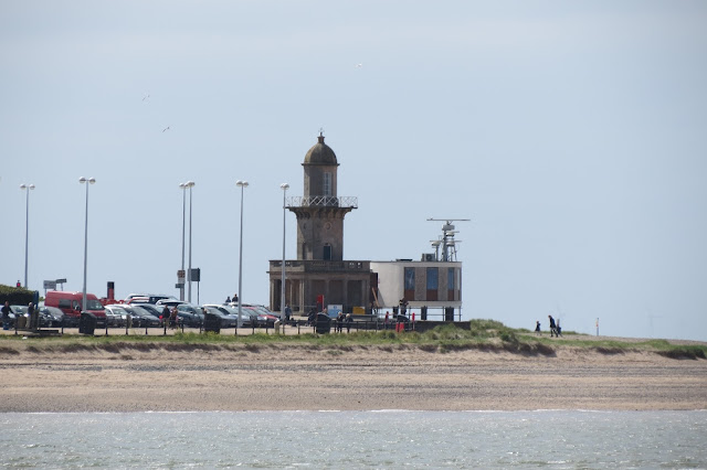
We parked up in a large car park by the golf club, which provided views across the mouth of the River Wyre towards Fleetwood, where old and new were juxtaposed.
Mind you, our carpark had an air of history about it that afternoon too.
It was a glorious day and, inviting though the expansive beach looked, we pressed on along the sea wall. Although the far side of Morecambe Bay was a little hazy we could still make out the southern fells of the Lake District. Black Combe, the most south-westerly of Cumbria's peaks can be seen here behind the freighter.
Rich enjoyed this walk more than I did, I think - probably because it was reassuringly flat underfoot throughout and there was no opportunity for me to drag him up to the top of a massive hill or lead us along narrow paths above steep drops. I found the early parts of the route a little dull but Knott End is certainly worth a visit for the salt marshes and I'd definitely like to go back and spend more time dedicated to exploring the wildlife at Barnaby's Sands and Burrows Marsh.
Just before we left Fleetwood, I cast a glance over to the east. I had been keeping an eye on the fells in that direction throughout my walk, particularly when we were walking through the subsidence-prone fields of Preesall - the hills looked satisfyingly solid, no danger there of the ground disappearing beneath our feet. They formed, as I had guessed, the Forest of Bowland AONB and the sun just caught them as we headed back to the car and made me more determined to explore them in the future.
Date: May 2015
Walk length: 9 km
Total ascent: 35 metres
We parked up in a large car park by the golf club, which provided views across the mouth of the River Wyre towards Fleetwood, where old and new were juxtaposed.
 |
| The Beach Lighthouse and the radar station at Fleetwood. |
 The Bond Bug |
It was a glorious day and, inviting though the expansive beach looked, we pressed on along the sea wall. Although the far side of Morecambe Bay was a little hazy we could still make out the southern fells of the Lake District. Black Combe, the most south-westerly of Cumbria's peaks can be seen here behind the freighter.
 |
| Black Combe on the south western corner of Cumbria |
 |
| Walking along the sea wall at Knott End |
 |
| I'm sure this chap is stalking me - wherever I walk, he turns up. |
Eventually, the guide advised us to turn away from the sea wall and head inland, through mostly residential streets, until we met a public footpath on the left. This led us along a tree-lined trail to farmland. We followed the trail until another public footpath briefly led us through a field up a steep hill and, through a farm, down to the country lanes around Preesall.
I am not keen on walking along roads, especially lanes where the national speed limit applies and where the twists-and-turns can make for hair-raising encounters with traffic - there was a section here where there was no verge on either side of the lane and space in the road for one vehicle. I suppose we would have had to walk back until there was enough space to pass had we met an oncoming car but thankfully we made it through without encountering one. We did meet some other locals though.
 |
| Probably even more concerning an encounter than cars, had we met them in the lane. |
One upside to the lanes was the mass of Queen Anne's Lace along the hedgerows and the air was steeped in its scent. I'd found the early stages of this walk a little dull but at this point, with more to see, things improved. There was even a glimpse of Blackpool Tower to be had in the distance.
It was quite striking how many fenced-off areas there were in the fields we passed and warning signs to keep out as well. Sometimes large sinkholes were visible and it seems like the whole area is prone to subsidence. I'm not sure why this would be so - maybe something to do with the salt mining that had taken place here in the past?
Leaving the lanes and farm tracks behind, we finally arrived at Barnaby's Sands and Burrows Marsh. The sea was out leaving the marsh strewn with a maze of tiny, muddy canyons. Although we couldn't see much of them at this stage, the reserve was obviously teeming with birds as their calls could be heard from all directions.
 |
| Looking across the salt marshes. |
I'm not a twitcher by any stretch but we used to have friends who lived in Leigh-on-Sea, Essex, and over the years I visited the nature reserve at Two Tree Island many times. I always seemed to see masses of the same two variety of birds there but as we progressed alongside the marsh here we saw a much greater diversity, albeit some were too fast for my ham-fisted photography attempts.
 |
| A shelduck. |
 |
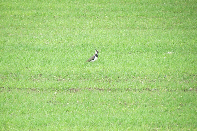
| A lapwing. |
 |
| A redshank (l) and a shelduck (r) |
 |
| An oystercatcher. |
The tide appeared to be coming in as the Wyre Way reached the end of the marsh but our path now took us away from the estuary and across Knott End golf course. On the way we passed Hackensall Hall. This is a beautiful listed building that hails from 1656. Despite having stood there for several centuries this is still a "new" version of the hall, a replacement for a previous manor that had been built in 1190 and subsequently destroyed by fire.
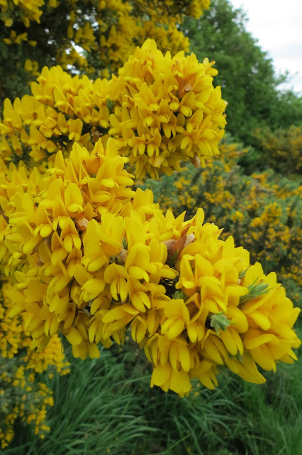
The gorse bushes were in full bloom on the golf course and the scent was heady - and a discovery. Although the deep fragrance was a familiar one from our walks, for some reason neither of us had ever made the connection with the gorse nearby, despite its eye-catching blossom.
 |
| Gorse in full bloom. |
 |
| Lotte refusing to pose for the camera. |
There were some good views to be had here in the late afternoon/early evening light, both up river and across the mouth of the Wyre, enough to tempt us to drive around to Fleetwood on our way home.
 |
| Looking up river. |
 |
| Fleetwood from Knott End. |
 |
| Looking out to sea. |
Rich enjoyed this walk more than I did, I think - probably because it was reassuringly flat underfoot throughout and there was no opportunity for me to drag him up to the top of a massive hill or lead us along narrow paths above steep drops. I found the early parts of the route a little dull but Knott End is certainly worth a visit for the salt marshes and I'd definitely like to go back and spend more time dedicated to exploring the wildlife at Barnaby's Sands and Burrows Marsh.
Just before we left Fleetwood, I cast a glance over to the east. I had been keeping an eye on the fells in that direction throughout my walk, particularly when we were walking through the subsidence-prone fields of Preesall - the hills looked satisfyingly solid, no danger there of the ground disappearing beneath our feet. They formed, as I had guessed, the Forest of Bowland AONB and the sun just caught them as we headed back to the car and made me more determined to explore them in the future.
 |
| The eastern fells of the Forest of Bowland. |
Date: May 2015
Walk length: 9 km
Total ascent: 35 metres


0 comments:
Post a Comment