Or, "How Poor Decision Making and Stubbornness Deprived Me of My Beer and Made Me Late for Dinner."
The Dark Peak is famous for its huge grit stone edges, draws for walkers and climbers alike, but few are quite as impressive as Stanage Edge: viewed from its southern end near Upper Burbage Bridge, the six kilometre sweep of millstone grit undulates before you like a breaking wave, permanently suspended above the Hope Valley. From the 458 metre vantage point of High Neb, Win Hill and the peaks of the Great Ridge seem diminished, while the vista over towards Eyam Moor is a gently rolling, pastoral affair; only the dark bulk of the Kinder Plateau beyond them feels like it can match this iconic escarpment in might.My walk was to take in Stanage Edge as its climax but I also wanted to explore Burbage Rocks first, another escarpment that runs south in the form of a broken crescent, from Upper Burbage Bridge to the Longshaw Estate.
I arrived in the area at Grindleford Station just after 8am. It was a lovely morning, as forecast, and a short climb up the public footpath by the side of the station house brought me to Main Road; a brief stroll along the lane and I turned left into Yarncliff Wood. Through the wood runs Padley Gorge and the water coursing along it is Burbage Brook, making its way down from the moors to join the River Derwent. It was really uplifting to have this magical place to myself - the wood was silent apart from the occasional chime of birdsong and the stream's repeated plash as it worked around and down the boulder-strewn bed.
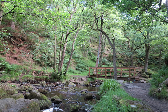 |
| Crossing Burbage Brook, the first of several times that morning. |
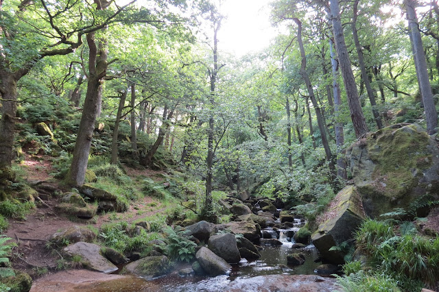 |
| In Padley Gorge. |
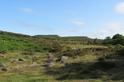 |
| Looking up to Hathersage Moor |
I pressed on and crossed the brook by a little footbridge, which took me briefly through trees again before I came out on the A6187. Just across the road were two footpaths - the left hand one was the Sheffield Country Walk, a managed trail that crosses the moor below Burbage Rocks, but my route was to the right along the escarpment itself.
 |
| Approaching the disused quarry. |
I find these places - common in areas of millstone grit - as fascinating in their own way as the natural rock formations that edge the moors and this one didn't disappoint, providing plenty of opportunities to clamber over rocks and investigate nooks and crannies. The corner of the quarry was marked by one particularly gravity-defying hewn piece of rock, daring the passer-by to stand beneath it, and there were several mill stones dotted around. To my uneducated eye they pretty much seemed finished and I wondered why they would go to so much trouble to carve them first from the rock face and then into shape only to abandon them on the hillside. It gave the site a Marie Celeste quality, as if the quarry had been abandoned suddenly. They weren't the only ones I would pass that day: I spotted others at the base of Stanage Edge later on and on a previous walk here had encountered others below the aptly-named Millstone Edge on the far side of the moor.
It was time to push on, interesting though this place was. There was a clearly defined climb up the side of the quarry that would get me to the top of Burbage Rocks much quicker than retracing my steps to rejoin my original route, and soon I was on top of the edge without much huffing and puffing.
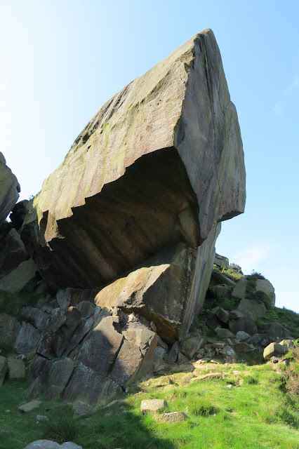 |
| The gravity-defying quarry corner. |
 |
| Carved out but abandoned. |
 |
| Looking back at the quarry, on my way up to the top of Burbage Rocks. |
 |
| My route up onto Burbage Rocks. |
The morning was a clear one and I had tremendous views from here of Hathersage Moor itself, of course, but also - beyond it - the Great Ridge and Kinder. The trail was an easy one to follow along the top of the edge though I had to descend at the break in the middle of Burbage Rocks and then head back up again.
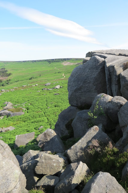 |
| The northern arc of Burbage Rocks from the southern section. |
 |
| The Great Ridge, in the middle ground - Rushup Edge is to its left and Win Hill on its right; Carl Wark is in the foreground and the Kinder plateau looms behind the Great Ridge. |
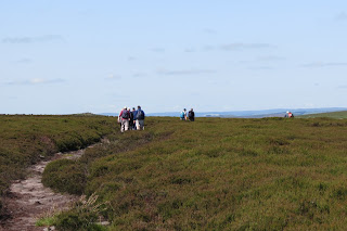 |
| The walkers I passed as I crossed the moor. |
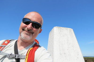 |
| At the Ox Stones trig column. |
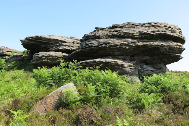 |
| The larger of the Ox Stones. |
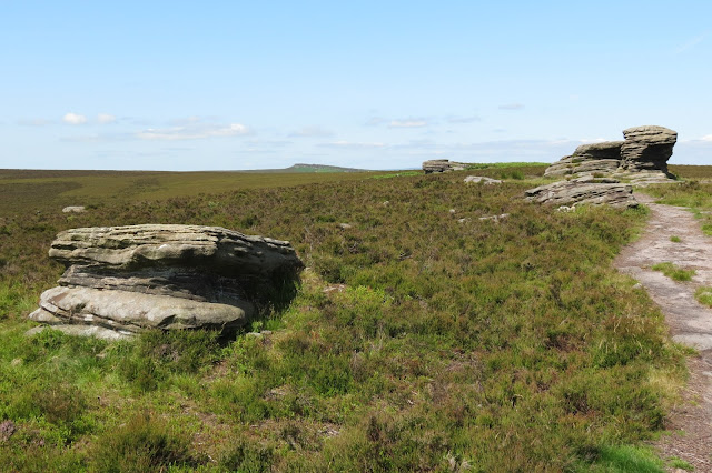 |
| Looking back across Burbage Moor to the start of Stanage Edge from the Ox Stones. |
Where the northern curve of Burbage Rocks ends it meets a smaller gritstone edge - Fiddlers Elbow - at the head of the clough formed by Burbage Brook; where the waters begin their journey down from Hallam Moors is Upper Burbage Bridge. A road runs across the top of the bridge but it was possible to avoid this and step across the rocky beds of the two confluences that form the brook below the watershed. I paused here to look back at the local Mountain Rescue team, who were practising winching a colleague on a stretcher up the rock face, and I exchanged pleasantries with a fellow walker who was watching the same while he ate his lunch. It turned out he had been out early like me and had booked an impromptu day's leave from work, as I had done, as soon as today's weather forecast looked certain.
 |
| Carl Wark (l) and Higger Tor (r) as I approached the end of Burbage Rocks. |
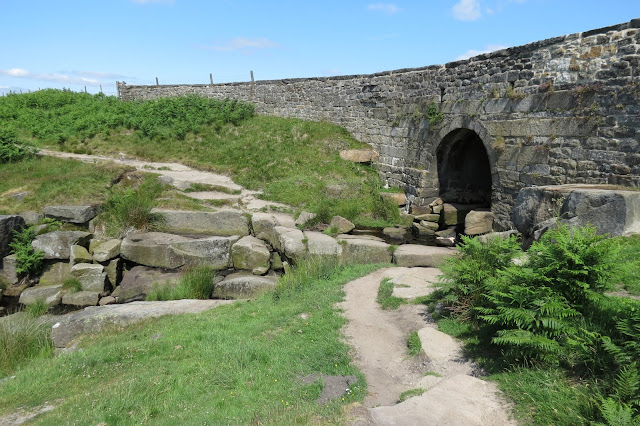 |
| Upper Burbage Bridge. |
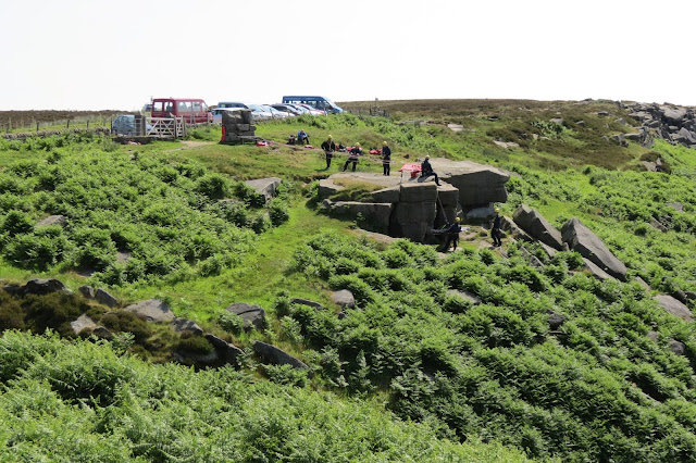 |
| Mountain Rescue on a training exercise. |
I carried on now across the road and back onto moorland. Ahead of me was the start of Stanage Edge, a strikingly verdant crag, its boulders interspersed with bushes and numerous bright green splashes from the ledges of grass that dotted its slopes and wreathed the outcrops of stone.
 |
| The crag at the start of Stanage Edge. |
To the right of the crag, overlooking the southern part of Hallam Moors, was the Cowper Stone, looking as if it were one of the Ox Stones that had been left behind by the herd in a trek across the moors.
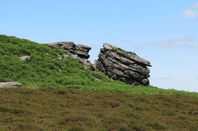 |
| The Cowper Stone. |
There is a trig pillar here at this end of the escarpment, which is easily accessible from several areas of roadside parking nearby, and the area was crowded with visitors. I decided to wait and see if it would quieten down and clambered onto a boulder below the edge, which made for a lunch spot with excellent views across to Eyam Moor. Unsurprisingly since it was such a sunny day, there was a steady stream of people walking towards Stanage Edge from the car park at Hooks Car below me and this was an indication of how busy the first section of the ridge was to be. I finished my sandwiches and chocolate and negotiated a route over the rocks to the top of the escarpment. It's while I was climbing and jumping from rock to rock here that I'm guessing I lost my sunglasses. I didn't realise at the time but in the picture I took shortly afterwards at the trig point above me they were missing from the loop on my shoulder strap.
 |
| A nice spot for lunch, looking over the valley towards Eyam Moor. |
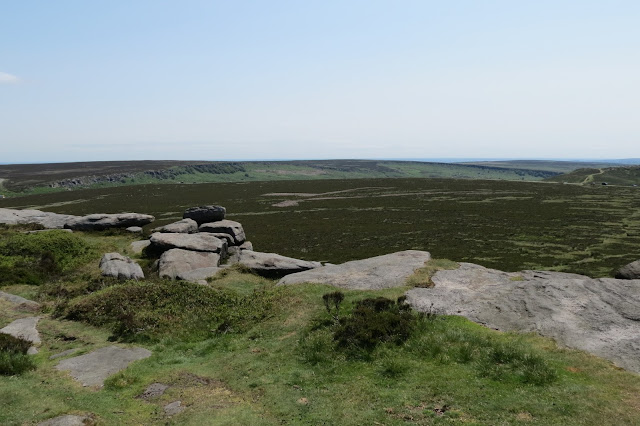 |
| Looking back across Hathersage Moor to the "broken crescent" of Burbage Rocks. |
 |
| Stanage Edge stretched out ahead of me. |
 |
| A rock with a view. |
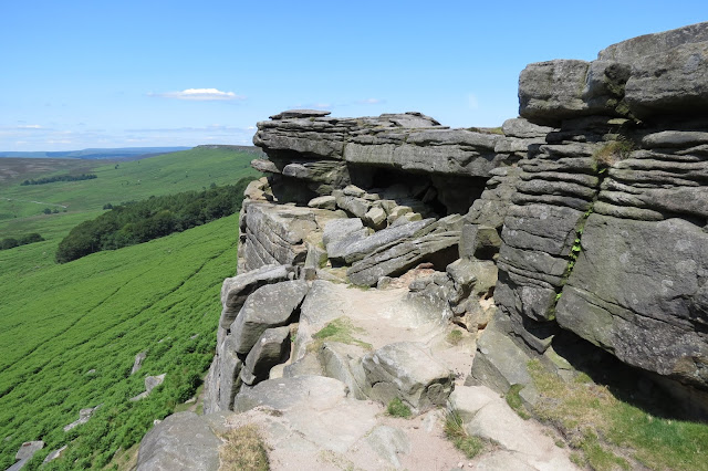 |
| Climbing down to the ledge that leads into Robin Hood's Cave. |
 |
| I baulked at the idea of crawling on hands and knees over the carpet thoughtfully left by the local sheep. |
 |
| The Long Causeway to Stanege Pole |
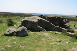 |
| Neither a pole nor a trig column to be seen... |
"No trig column!" might also have been the cyclist's greeting for curiously there was no OS marker here either, even though it shows on the OS 1:25000 map (and on the online version I am looking at now too). As far as I can tell there never was one constructed here either, making the spot something of a curiosity in British map lore. Comforted by the fact that there was still at least something notable about the spot, I tramped back along the Long Causeway and rejoined my route along the edge.
 |
| Looking back as I headed further along the ridge, passers-by were a rarity now. |
 |
| High Neb ahead of me - the climbers on the ridge were out of sight by the time I reached the top. |
 |
| The result of last season's heather burning, I assume. |
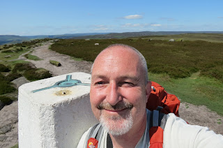 |
| At High Neb. |
I passed barely a handful of walkers between the Long Causeway and this point, and none at all once I continued on to Stanage End. The only other people around were a few climbers that I could see at High Neb and by the time I reached the summit I could only tell they still around at all from the sound of their voices below.
There was a trig column at High Neb and I paused to mark bagging this summit before carrying on. I had made decent time, considering the diversions I had made and the pauses to explore the rock features that were a defining feature of this walk, so I had a spring in my step. The views across Bamford Moor and Moscar Moor were tremendous from here too and they gave me an extra bounce in my stride as I went.
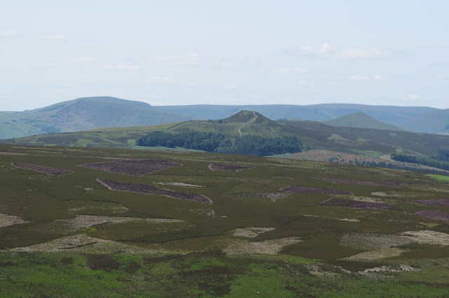 |
| Across Bamford Moor: Mam Tor (l), Winhill Pike (m) and Lose Hill (r), with Kinder behind. |
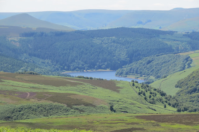 |
| Across Moscar Moor: Ladybower Reservoir. |
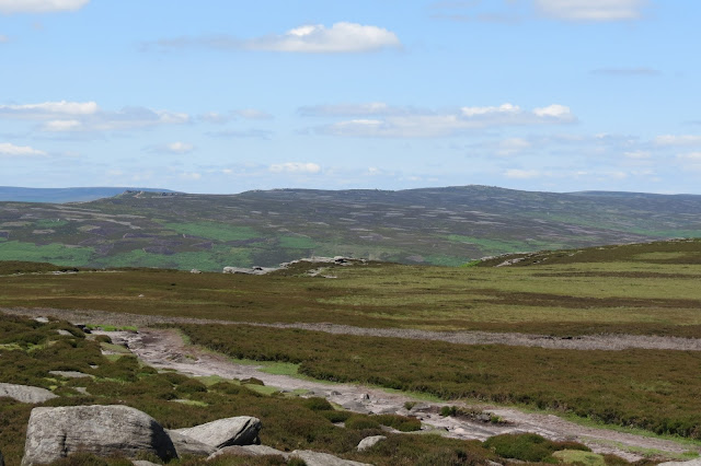 |
| Across Derwent Moor: Derwent Edge. |
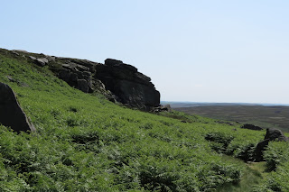 |
| Heading down onto Bamford Moor. |
 |
| Looking up at the edge from Bamford Moor, while the path was still visible. |
To my left bracken and heather seemed to promise drier ground underfoot and I struck out through it - to say it was hard work was an understatement. The bracken was growing at shoulder height the further in I went and was wrapping itself around my lower legs as I forced my way through it. After a fruitless 45 minutes' worth of struggling I found myself in another mire, one in which there was nowhere to stand still and regroup. Whenever I paused I began sinking slowly but steadily into the bog. So I hopped around and cursed loudly at the obstinacy that had led me there. In real terms I was no closer to Bamford and its railway station; in fact, time-wise I was further away than ever, something another 45 minute battle through the undergrowth back to my starting point subsequently proved.
 |
| My nemesis. |
 |
| Heading back up to Stanage Edge. |
 |
| The grim and squelchy trudge down to the Snake Road. |
From here it was a trudge, distinctly damp from the knees down, back to Crows Chin Rocks and then onwards to the Snake Road, where Rich was to pick me up from the Cutthroat Bridge lay-by.
In the event, we were still late for dinner by the time we'd got back to Manchester and I'd showered and changed, but if nothing else I had worked up both a hearty appetite and a saga of derring-do with which to regale the family over our meal. It wasn't the best end to what had been a great day's walking but nor was it the disaster it'd seemed for a while when I was swallowed up in bracken and sphagnum moss. And - having been slap bang in the middle of my own cautionary tale - I learned the valuable lesson there's nothing wrong with turning back and plotting a more convenient or easier route when the going gets tough underfoot.
Date: July 2015
Total ascent: 748 metres


0 comments:
Post a Comment