Thor's Cave above the Manifold Valley has long been on my list of places to visit and at the end of June we drove out late one Sunday afternoon to explore this area of the White Peak. Along the lower reaches of the valley itself runs the Manifold Way, from Hulme End to Waterhouses: this was once the route of the relatively short-lived Leek and Manifold Valley Light Railway (L&MVLR), which maintained a economically-precarious existence from 1904 to 1934 before finally giving up the ghost. The Wiki entry on the Manifold Way mentions a wag among the railway workers on the line describing it as a "line that started in the middle of nowhere, and ended up in the same place", and his quip succinctly explains its demise.
Our walk started at the northern end of the trail at Hulme End. The station at the head of the railway line once stood here and there is a pay-and-display car park, public toilets and a visitor centre. It was fairly late in the afternoon when we started out but the weather was glorious and the sunset wasn't due until after 9.30 so we relished the thought of a walk into the early evening. As we followed the tarmac path (the trail has good accessibility for pushchairs and wheelchairs though occasionally shares a route with motor traffic), Ecton Hill appeared to our left. I'd mentioned to Rich that there was a hill at the end of the route but when it suddenly loomed into view I prudently decided to keep quiet for now that this was it.
Not far from the visitor centre the Manifold Way became increasingly enclosed by trees and bushes and the river began to drop away from us below. It was difficult to judge whether this was because the trail was continually but imperceptibly heading upwards or because the valley was deepening as we progressed. We only got occasional glimpses now of the calm waters of the river through the foliage.
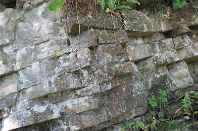
The sides of the valley on the right of the footpath afforded some interest however as the area is something of a geological smorgasbord. We spent a fruitless twenty minutes or so squinting at the strata in the hope of seeing some of the many fossils that are held in the rock face but eventually gave up and carried on our way. My suspected fossil - a knobbly, cone-shaped bulge about the size of a cherry - was roundly dismissed, and when I looked at the not-very-good photograph at home later I was forced to admit it probably was a case of wishful thinking on my part.
As we approached Ecton Bridge, I noticed a footpath leading down towards the river from the trail and, bored with tarmac, we decided to explore. After a steep and muddy clamber downhill we found ourselves in a meadow. Ahead was a small footbridge, crossing the River Manifold, and on the far side, was Ecton Bridge. The Manifold Way crosses the river via the latter and this lane is one of the sections where the trail is shared with traffic.
After a short climb, the footpath took a sharp turn downhill and we walked down into the valley below Wetton Hill. The hill itself was crowned with limestone outcrops and seemed a tempting proposition but National Trust signs required us to stick to the designated paths through the farmland so we carried on at ground level until we rejoined the Manifold Way.
The trail was now closely following the dry bed of the River Manifold and the massive crag that housed Thor's Cave became an increasingly dominant presence ahead of us. It was really only at this point that we became fully aware of the climb we would have to visit it.
An ugly bridge led us from the Manifold Way into the woods that skirt the base of the crag and we began our ascent along a muddy but rock strewn trail. The going soon became considerably easier when we joined a series of stone steps, perhaps a relic from Victorian times when the cave was as popular a tourist destination as it is now.
Our walk started at the northern end of the trail at Hulme End. The station at the head of the railway line once stood here and there is a pay-and-display car park, public toilets and a visitor centre. It was fairly late in the afternoon when we started out but the weather was glorious and the sunset wasn't due until after 9.30 so we relished the thought of a walk into the early evening. As we followed the tarmac path (the trail has good accessibility for pushchairs and wheelchairs though occasionally shares a route with motor traffic), Ecton Hill appeared to our left. I'd mentioned to Rich that there was a hill at the end of the route but when it suddenly loomed into view I prudently decided to keep quiet for now that this was it.
 |
| Ecton Hill |
 |
| The trail is easy underfoot. |
 |
| Strata at the side of the Manifold Way |
The sides of the valley on the right of the footpath afforded some interest however as the area is something of a geological smorgasbord. We spent a fruitless twenty minutes or so squinting at the strata in the hope of seeing some of the many fossils that are held in the rock face but eventually gave up and carried on our way. My suspected fossil - a knobbly, cone-shaped bulge about the size of a cherry - was roundly dismissed, and when I looked at the not-very-good photograph at home later I was forced to admit it probably was a case of wishful thinking on my part.
As we approached Ecton Bridge, I noticed a footpath leading down towards the river from the trail and, bored with tarmac, we decided to explore. After a steep and muddy clamber downhill we found ourselves in a meadow. Ahead was a small footbridge, crossing the River Manifold, and on the far side, was Ecton Bridge. The Manifold Way crosses the river via the latter and this lane is one of the sections where the trail is shared with traffic.
 |
| Horses grazing in a buttercup meadow to our left as we took a short cut to Ecton Bridge. |
 |
| Ecton Bridge. |
 |
| Our Little Pony |
It was good to be out in the open air again, particularly as it was such beautiful weather. On the far side of the meadow, we rejoined the trail as it followed the lane. From here on, although the next section of the Manifold Way was still tree-lined to begin with, the trail soon became open to the skies and we had clear views down the lush valley.
Before long we reached a broad metal gate and beyond this the Manifold Way was closed to vehicles again. In the field next to us, was a tiny pony, standing at his own gate and staring forlornly through the metal bars - it looked like he was gazing over at the full-sized horses in the meadows opposite, though I doubt he could see them from where he was. When we returned to this point a couple of hours later he was standing in exactly the same position and staring blankly in the same direction, which was a little disconcerting.
At this point, however, we were merely charmed by the slightly odd-looking little fella and headed on up the trail. To the left, the rocky valley side rose steeply above us, the strata in almost ruler-straight lines or twisted into folds like strudel; to the right, the valley was now a considerable distance below us and the Manifold snaked through the pastures.
 |
| The Manifold Way after crossing Ecton Bridge |
 |
| Looking down the valley. |
 |
| A tree-dotted hill on the far side of the valley. |
 |
| Behind the mill. |
After the trail had opened out and the trees on our left were replaced with grassy hillside, we passed a National Trust sign for Dale Farm and trailers full of brand new, wooden fence posts. The farm itself lay some way ahead, just by Wetton Mill, which is itself a National Trust property: Wetton used to be a water mill for grinding corn but now contains a tea shop and toilet facilities.
One curiosity of this location is that in dry weather the River Manifold disappears below ground here, sinking into the porous limestone, only resurfacing some miles further south through boil holes at Ilam.
One curiosity of this location is that in dry weather the River Manifold disappears below ground here, sinking into the porous limestone, only resurfacing some miles further south through boil holes at Ilam.
The sun was still beating down even this late in the day, so we paused to buy ice lollies before taking the public footpath behind the roof of the mill. As we made our way up the flower-strewn slope, we got our first view of Thor's Cave at the top of a massive limestone crag further down the valley.
 |
| In the meadow above Wetton Mill. |
 |
| Our first view of Thor's Cave. |
After a short climb, the footpath took a sharp turn downhill and we walked down into the valley below Wetton Hill. The hill itself was crowned with limestone outcrops and seemed a tempting proposition but National Trust signs required us to stick to the designated paths through the farmland so we carried on at ground level until we rejoined the Manifold Way.
 |
| Rich with Wetton Hill behind him. |
 |
| In the dale below Wetton Hill. |
An ugly bridge led us from the Manifold Way into the woods that skirt the base of the crag and we began our ascent along a muddy but rock strewn trail. The going soon became considerably easier when we joined a series of stone steps, perhaps a relic from Victorian times when the cave was as popular a tourist destination as it is now.
 |
| The empty bed of the River Manifold. |
 |
| Climbing up to the cave. |
The view from the valley really hadn't given us a clear sense of the size of Thor's Cave and the sight of its gaping mouth when we emerged from the tree cover was quite awe-inspiring. The cave is a karst formation and clambering into it required hands as well as feet, as the limestone beneath us was worn as smooth and as slippery as ice - I nearly came a cropper a couple of times.
What struck me immediately inside the cave - aside from its airy immensity - was the extraordinary organic feel to its sweeping and curving walls and roof. Had the surface been darker it would almost have been like walking through the ruined spaceship at the start of Ridley Scott's Alien movie.
A second smaller cave mouth (behind me in the photo above) affords the visitor plenty of natural light and a cool breeze too, making this natural shelter a welcome resting place in hot weather. There is a precipitous drop below this smaller opening, however, so it should be approached with caution from within.
To the left, the cave splits into two dark tunnels that disappear into the hillside. We spent a good while here clambering around and exploring - the camera flash lit up some way into the these passages but we were wary of venturing too far, not knowing how far they went back or what might lie underfoot - or even whether a misstep might lead to there suddenly being nothing underfoot.
 |
| Rich, with the main entrance behind him. |
 |
| Both cave mouths,viewed from within. |
 |
| The two tunnels at the rear of the cave. |
Fascinating though the cave was, the views across the Manifold Valley from this natural vantage point were equally breathtaking.
After some time exploring the interior of the cave and speculating on how far back it went, we retraced our way down the steep hillside and back along the Manifold Way in the direction of Wetton Mill. Just before we made our way down behind the stone buildings, Rich noticed another cave halfway up the hill, above the National Trust property.
This turned out to be one of the Nan Tor caves, a feature that had completely passed me by when I was plotting our route on the OS website. It appears to be one of several caves connected by a network of tunnels, having looked it up afterwards, but on the day we thought the large, roofless chamber was the extent of it. It was impressive nonetheless, though the soft mud that coated much of its rocky floor made navigating it - and even simply standing still for a photo - somewhat challenging.
Fortunately, we - just! - remained on our feet during this short diversion, and returned to the trail without getting ourselves plastered in mud. Another diversion lay ahead of us when we started along the footpath that ran past Dale Farm however. Our plan had been to end the walk by bagging the summit of Ecton Hill, approaching it from the far side and taking in the rock outcrop known as Sugarloaf on the way.
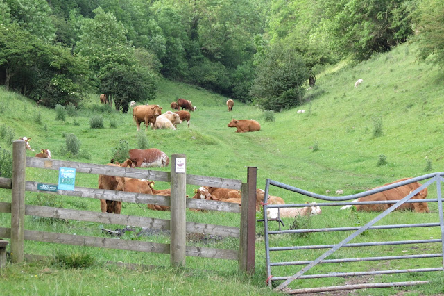
When we reached the gate behind the farm, however, the pasture ahead contained a herd of large cattle, some of which were wandering across the footpath or resting on the edge of it. Several of them looked up when we appeared at the gate and the idea of making our way between them didn't appeal, particularly as the field was a lengthy one that stretched up the hillside.
After a quick check of the OS map, we found a footpath heading sharply up Ecton Hill from the lane by Ecton Bridge and decided to walk back along the Manifold Way to this point, disappointing though it was to be revisiting for such a long stretch ground we had already covered.
The early evening sun made the stroll back to Ecton Bridge pleasant enough. And it was still surprisingly strong by the time we started our ascent of Ecton Hill, making an already strenuous climb even more of an effort. The lower part of the hill was shrouded in scrubby bushes and the still air where the path weaved between them vibrated with flies and gnats, many of them ready for an evening meal it seemed. This was unfortunate for Rich, who got bitten mercilessly, even with insect repellent on. I don't often get bitten by bugs nor do I react badly on the rare occasions it happens but poor Rich still bears the wheals from the feast they had that day and I'm writing this two weeks later.
Finally we emerged on the upper slopes where the vegetation fell away behind us leaving only grass and rocks underfoot and a pronounced, cooling breeze around us.
This was doubly welcome as it provided respite from both the heat and the insects. It was but a short walk to the top now, over a stile and then cutting across the corner of a field in a north-east direction.
Ecton Hill is a fascinating area, its copper and lead deposits having been worked for over 3500 years, as far back as the Bronze Age: a small sign had warned us at the lane to be wary of leaving the many well-trodden paths that criss-cross its slopes and this is because of the many ventilation shafts and sink holes that lead into the mines hundreds of feet beneath the surface. Both above and below ground, the area is now designated a Site of Special Scientific Interest (SSSI).
That aside, it also deserves to be noted for its rewarding views too, offering as it does a beautiful panorama of the White Peak. The distinctive ridged spines of Chrome and Parkhouse Hills were visible to the North West and Axe Edge Moor loomed on the horizon beyond them; to the east, the hills of the Derbyshire Dales rolled like green waves; south lay the heights above the Manifold Valley and all around for miles a jumble of woods and farmland, with occasional church towers pointing skywards.
This turned out to be one of the Nan Tor caves, a feature that had completely passed me by when I was plotting our route on the OS website. It appears to be one of several caves connected by a network of tunnels, having looked it up afterwards, but on the day we thought the large, roofless chamber was the extent of it. It was impressive nonetheless, though the soft mud that coated much of its rocky floor made navigating it - and even simply standing still for a photo - somewhat challenging.
 |
| Rich outside the cave at Nan Tor. |
 |
| The roofless cave interior. |
 |
| Thor's Cave from the cave at Nan Tor. |
When we reached the gate behind the farm, however, the pasture ahead contained a herd of large cattle, some of which were wandering across the footpath or resting on the edge of it. Several of them looked up when we appeared at the gate and the idea of making our way between them didn't appeal, particularly as the field was a lengthy one that stretched up the hillside.
After a quick check of the OS map, we found a footpath heading sharply up Ecton Hill from the lane by Ecton Bridge and decided to walk back along the Manifold Way to this point, disappointing though it was to be revisiting for such a long stretch ground we had already covered.
 |
| The pasture we decided not to traverse. |
The early evening sun made the stroll back to Ecton Bridge pleasant enough. And it was still surprisingly strong by the time we started our ascent of Ecton Hill, making an already strenuous climb even more of an effort. The lower part of the hill was shrouded in scrubby bushes and the still air where the path weaved between them vibrated with flies and gnats, many of them ready for an evening meal it seemed. This was unfortunate for Rich, who got bitten mercilessly, even with insect repellent on. I don't often get bitten by bugs nor do I react badly on the rare occasions it happens but poor Rich still bears the wheals from the feast they had that day and I'm writing this two weeks later.
 |
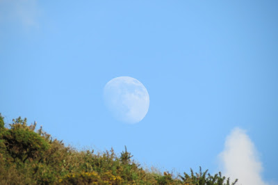
| The moon rising, as we approached the top of Ecton Hill. |
This was doubly welcome as it provided respite from both the heat and the insects. It was but a short walk to the top now, over a stile and then cutting across the corner of a field in a north-east direction.
Ecton Hill is a fascinating area, its copper and lead deposits having been worked for over 3500 years, as far back as the Bronze Age: a small sign had warned us at the lane to be wary of leaving the many well-trodden paths that criss-cross its slopes and this is because of the many ventilation shafts and sink holes that lead into the mines hundreds of feet beneath the surface. Both above and below ground, the area is now designated a Site of Special Scientific Interest (SSSI).
 |
| Approaching the handsome trig column on Ecton Hill. |
That aside, it also deserves to be noted for its rewarding views too, offering as it does a beautiful panorama of the White Peak. The distinctive ridged spines of Chrome and Parkhouse Hills were visible to the North West and Axe Edge Moor loomed on the horizon beyond them; to the east, the hills of the Derbyshire Dales rolled like green waves; south lay the heights above the Manifold Valley and all around for miles a jumble of woods and farmland, with occasional church towers pointing skywards.
 |
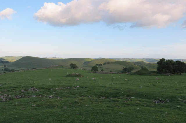
| Looking across to farmland above the Manifold Valley. |
 |
| Parkhouse Hill with Chrome Hill behind it to the left. |
 |
| Axe Edge Moor on the horizon. |
 |
| Looking east across the Derbyshire Dales. |
 |
| OS viewpoint |
We lingered a good while at the top of Ecton Hill, grateful for the rest and mesmerised by the views. To my mind, this spot merits one of those little fan-like symbols that mark a viewpoint on the OS maps and it's a mystery to me that it doesn't have one.
We became conscious of the time as we watched the sun sinking on the horizon and decided to head down, following a path that led north east and then north west along the walled edge of a pasture. Once we'd rejoined the road the early stage of the Manifold Way was in front of us and we followed it back to the visitor centre at Hulme End.
The walk had taken a surprisingly long time given its relatively short length but there was a good deal of interesting geology along its course to explore and often the views it provided were reason enough to pause and enjoy.
Date: June 2015
Walk length: 14 km
Total ascent: 776 metres


0 comments:
Post a Comment