Living in Manchester means that Snowdonia is within just as easy reach for us as the Yorkshire Dales or the Peak District, particularly with the A55 coastal road offering a ready entry into north and central Wales from various points along its course. The Welsh national park is an area we've wanted to explore for a while and the advent of "The Glorious Twelfth" has prompted me to map out a few routes away from the moors during the shooting season. So it was that, with a day of unalloyed sunshine forecast, I settled on the relatively small peak of Moel Siabod as our first Welsh mountain of the season.
We set off early and were lucky to find a space in a lay-by right at the start of our route. We parked next to Llynau Mymbyr. Originally one long lake this is now effectively a pair due to a build-up of sediment in the middle. Looking down from higher altitudes the effect is rather like observing a giant amoeba splitting in two. There remains a passable channel at the moment, it seems, as we later saw canoeists from the Plas y Brenin Mountain Centre at the south western end but no doubt in years to come they will have to carry their boats between the two expanses of water.
From our car, we headed down the side of the centre towards a footbridge that would take us into Bryn-engan Wood. Looking along the valley Dyffryn Mymbyr, Snowdon dominated the horizon, its flanks and peaks wreathed by a bank of cloud.
Our path lay in the opposite direction and, after pausing to take in the mountain's majesty, we followed a path through the trees that was roughly parallel with the course of the River Llugwy.
We were above the river for most of this section but we could hear it below us to our left and eventually, the path descended and was directly beside it at Capel Curig. What seemed to be a small creek caught my attention and I scrambled down the bank to its gravelly shoreline. Beyond a tiny island the Llugwy was in torrent over the massive rocks that form its bed but amazingly the waters here were still and mirror-like.
I lingered here to marvel at the scene until banging my head on a large, low-lying branch broke the magic spell and I clambered back up to Rich and the path.
It wasn't much further along that we came to a sharp turn in the river and it took us a while, precariously sliding down rocks to the bank and back up, before we managed to find our way to where the path continued along the waterside. Gradually the tree cover thinned and we were in a pasture with the ridge of Moel Siabod forming a satisfying peak above us. Crossing the field, we exited onto a lane at Pont Cyfyng. The river, which had calmed down as it flowed alongside the pasture, now roared and spumed thanks to the dramatic shift in the size and formation of the rocks here; although we didn't see any this far down, it seems to be a spot that's understandably popular with kayakers.
We turned right, heading uphill along the lane, and a fair old slog it was too, as ascents on tarmac always seem to be. It got much easier shortly after (though it didn't seem that "shortly" at the time) when we joined a rougher path that took us through thick bracken to an old quarry track. The views north west from here were tremendous. I've listed the peaks on the photo caption as far as I could identify them using the OS map but I can't guarantee I'm correct!
We were out in full sun now and the quarry track was pretty good walking, save for the punishing heat. It wasn't long before we were at the site of the old quarries, where some of the deeper sections were now filled with water. The first of these we came upon was shallow-sided and looked like one of the many small reservoirs that dot the peaks of England and Wales. However, after climbing past several gleaming heaps of slate that looked as though they might slide down at the slightest provocation, we came to a second pit that was far more picturesque. Tiny cascades of water flowed into it from the mountain face above and a verdant ledge on the far side lent it the air of a pastoral painting. There were no gambolling lambs or nymphs and shepherds on view today, though, and we pressed on.
"If he or she is still there when we get to the top, I'll offer to email them a copy of the picture," I thought, underestimating the climb ahead as much as I was overestimating the quality of my eyesight.
After pointing and zooming for a good while and taking numerous pictures of wildly varying quality, I noticed that my "climber" was an unusually motionless one. Eventually, squinting at the image on my camera screen, it dawned on me that I'd been taking pictures of a shaded lump of rock for about fifteen minutes. It might have been less embarrassing if only Rich had shared my mistake but I'd pointed the rock out to a passer-by who'd asked what I was photographing.
The path, which followed a mostly dry stream bed, peaked on a kind of moorland plateau - below us was a hanging valley, the summit ridge towered above that and the beautiful lake Llyn-y-Foel formed the focal point of the scene. We'd climbed a fair amount by this time and this seemed like the ideal spot for lunch before heading to the summit. A few outcrops of rock showed through the heather and the peat was surprisingly dry and bouncy underfoot, so it wasn't hard work to find a natural seat where we could offload our bags and tuck into our butties overlooking the tarn. The crumpled summits of the Moelwyns, Moel Siabod's extended family, dominated the horizon south of our resting place, the Crimea Pass cutting a path through them to Blaenau Ffestiniog. It was an idyllic spot to rest.
Tempting though it was to hang around this idyllic spot, there was still a fair climb to go before we reached the summit so as soon as we'd eaten we made our way down to the valley. Some walkers ahead of us were tracing a path to our right along the base of the summit ridge. This formed an arc above us and swept down to the hanging valley in the rough-hewn form of Daear Ddu. Looking up we could see people ascending via this popular scramble route to the top. There also seemed to be a path straight across the plateau and this is the way we headed at first before the ground became too sodden to continue; we probably could have made it if we'd persevered but neither of us fancied a boot full of water on the climb ahead so we made a sharp turn towards the rocky path under the cliffs. It was good to get a different perspective on Llyn-y-Foel from "ground level" (or, perhaps, "lake level" to be more accurate) - it truly is a beautiful tarn from whatever viewpoint you see it, as the walk continued to prove.
Although the scramble route would have been a quicker climb to the top, Rich wasn't comfortable with the idea so we'd plotted a gentler ascent on the southern side of the mountain. Crossing the back of Daear Ddu we joined a reasonably well-trodden path up a grassy slope. Gentler inclines mean longer journeys, of course, but even so I was surprised at how the rock-crowned summit above us never seemed to get any closer as we climbed. The terrain gradually become far stonier as we gained height and we had to use hands and feet at times to heave ourselves up over a boulder or clamber over massive rock slides. Some of the rocks here were so big, you wondered that they could have moved at all, let alone flowed down the hillside like water. At times here the path ahead became less obvious underfoot but it was generally easy to pick it up again with a bit of scouting around and the views to the south of Moel Siabod really opened up now, providing plenty of opportunities for taking a breather photographs.
Finally, we hit a fence running roughly SW to NE and the broad, stone-strewn track alongside it led us straight to the summit, a fine display of jagged, weather-sculpted rock surmounted by a trig pillar. We hung around here for a short while, waiting among the surprising number of people there to pose for the obligatory photo, and soaking up the views.
And they were excellent views too, particularly of Snowdon. For some reason, though, when I got home I found I had taken hardly any pictures of the great mountain.At the time, I had it in my head that I'd snapped plenty. I don't know what I was thinking and it was certainly an opportunity missed. I think I was so distracted by Yr Aran at the end of the South Ridge and focusing on getting photos of that shapely peak that I forgot to look at the bigger picture. North-east of Snowdon, the Glyderau and the iconic, dragon's-back ridge of Tryfan dominated the views.
Running north-east below we could see the knotty ridge descending towards Capel Curig and plenty of walkers were following this vertiginous route down the mountain. In contrast to the dramatic eastern face of Moel Siabod, the other side of the mountain slopes much more gently from the broad summit plateau. A well-established path leads down this side to the Bryn-engan Woods. It was this route we'd picked as an "easy" one back to our car but if I do the walk again, I think I'll head down the ridge. There are certainly some fine views to be had from this path, across to the High Carneddau, for one - and Snowdon too if you're climbing to the summit this way - but it is a far less-varied route than the one we took to the top. The loose pebbles and, subsequently, more cobble-like stones are sole-destroying and soul-destroying after a while too, though it might be easier going as an ascent.
Finally we regained the forest trail we had started out on and from here it was but a short walk back to the car. Although not overly long, this proved a surprisingly tiring trip - there was 2800 feet of ascent in total (and that interminable downhill slog at the end!) but I think the heat made it feel harder work than it would have on a spring or autumn day. All that said, it was a really enjoyable introduction to Snowdonia and, as we supped our pints of shandy at the Swallow Falls Hotel, we reflected with pleasure on the variety of terrain and the wonderful views we'd enjoyed.
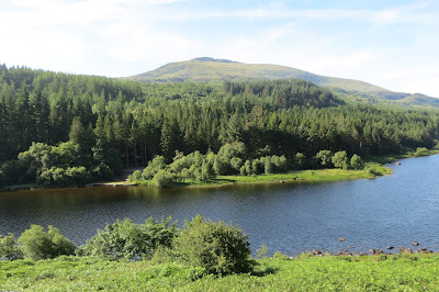 |
| Moel Siabod from Llynau Mymbyr |
From our car, we headed down the side of the centre towards a footbridge that would take us into Bryn-engan Wood. Looking along the valley Dyffryn Mymbyr, Snowdon dominated the horizon, its flanks and peaks wreathed by a bank of cloud.
 |
| Snowdon |
 |
| Llynau Mymbyr with The Ricks and Racks on the right. |
Our path lay in the opposite direction and, after pausing to take in the mountain's majesty, we followed a path through the trees that was roughly parallel with the course of the River Llugwy.
 |
| An oasis of tranquility - and low-hanging branches. |
I lingered here to marvel at the scene until banging my head on a large, low-lying branch broke the magic spell and I clambered back up to Rich and the path.
It wasn't much further along that we came to a sharp turn in the river and it took us a while, precariously sliding down rocks to the bank and back up, before we managed to find our way to where the path continued along the waterside. Gradually the tree cover thinned and we were in a pasture with the ridge of Moel Siabod forming a satisfying peak above us. Crossing the field, we exited onto a lane at Pont Cyfyng. The river, which had calmed down as it flowed alongside the pasture, now roared and spumed thanks to the dramatic shift in the size and formation of the rocks here; although we didn't see any this far down, it seems to be a spot that's understandably popular with kayakers.
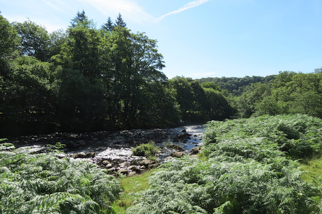 |
| Following the river. |
 |
| We weren't the only ones trying to cool down. |
 |
| The summit of Moel Siabod from the north-east. |
We turned right, heading uphill along the lane, and a fair old slog it was too, as ascents on tarmac always seem to be. It got much easier shortly after (though it didn't seem that "shortly" at the time) when we joined a rougher path that took us through thick bracken to an old quarry track. The views north west from here were tremendous. I've listed the peaks on the photo caption as far as I could identify them using the OS map but I can't guarantee I'm correct!
 |
| On the way up from Pont Cyfyng |
 |
| Pen Llithrig y Wrach (l), Craig Wen and Creigiau Gleision (r) |
 |
| From l to r : Carnedd Llewelyn, Pen yr Helgi Du, Pen Llithrig y Wrach, Craig Wen and Creigau Gleision |
 |
| Following the old quarry track to the base of the summit. |
 |
| A path through the slate. |
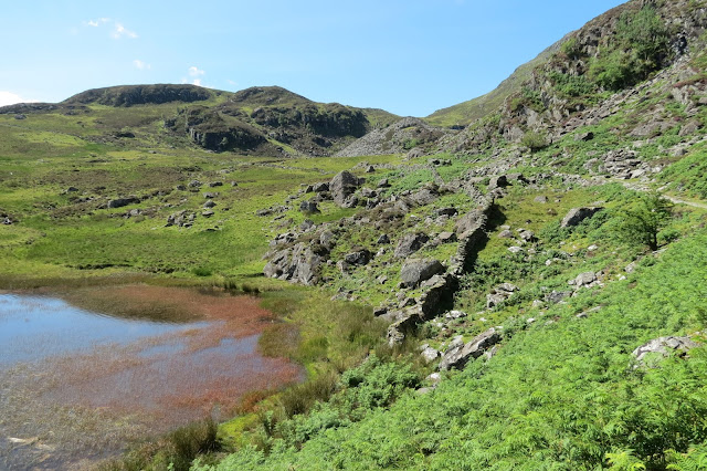 |
| Passing the first of the water-filled quarries. |
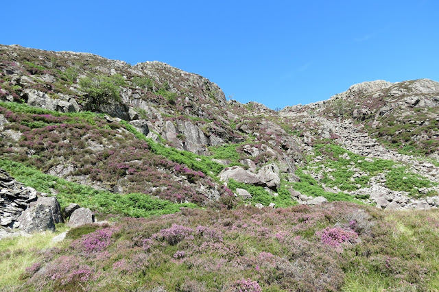 |
| Heather beginning to bloom on the slopes of the ridge. |
 |
| It'll soon be Christmas... |
 |
| The Arcadian second quarry. |
Looking up at the moon, which was framed perfectly by the summit ridge, we stopped at my insistence as I tried to get a picture of what I thought was a climber just below the uppermost crags.
After pointing and zooming for a good while and taking numerous pictures of wildly varying quality, I noticed that my "climber" was an unusually motionless one. Eventually, squinting at the image on my camera screen, it dawned on me that I'd been taking pictures of a shaded lump of rock for about fifteen minutes. It might have been less embarrassing if only Rich had shared my mistake but I'd pointed the rock out to a passer-by who'd asked what I was photographing.
The path, which followed a mostly dry stream bed, peaked on a kind of moorland plateau - below us was a hanging valley, the summit ridge towered above that and the beautiful lake Llyn-y-Foel formed the focal point of the scene. We'd climbed a fair amount by this time and this seemed like the ideal spot for lunch before heading to the summit. A few outcrops of rock showed through the heather and the peat was surprisingly dry and bouncy underfoot, so it wasn't hard work to find a natural seat where we could offload our bags and tuck into our butties overlooking the tarn. The crumpled summits of the Moelwyns, Moel Siabod's extended family, dominated the horizon south of our resting place, the Crimea Pass cutting a path through them to Blaenau Ffestiniog. It was an idyllic spot to rest.
 |
| Llyn-y-Foel from our lunch spot, with the Moelwynion behind. |
 |
| Moel Farlwyd, I think. |
 |
| The summit ridge of Moel Siabod. |
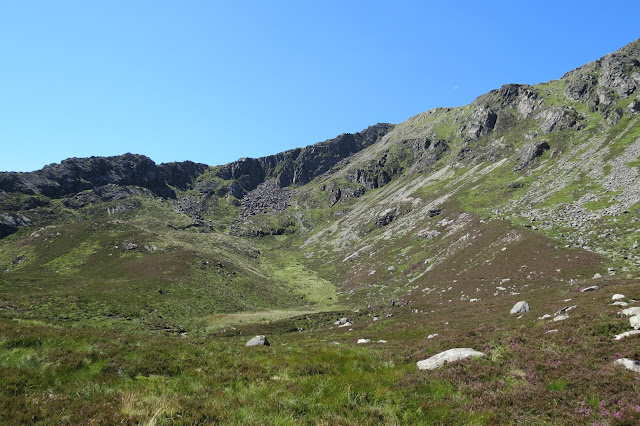 |
| The dark section of the ridge from left to right is Daear Ddu, a popular scramble route up. |
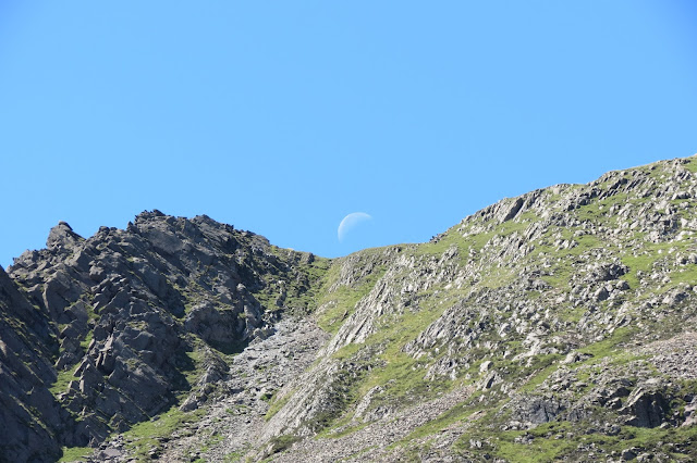 |
| The top of Daear Ddu (l) - no climbers, real or otherwise, to distract me in this shot. |
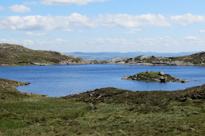 |
| Llyn-y-Foel, looking east as we crossed the plateau. |
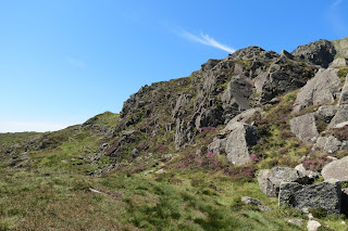 |
| Crossing Daear Ddu, we headed up the southern slopes |
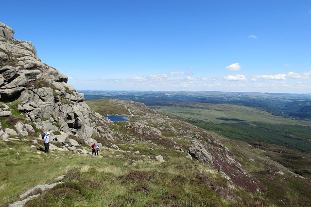 |
| Looking back down towards Lyn-y-Foel |
 |
| The route up. |
 |
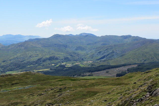
| Looking through the Crimea Pass to Tanygrisiau Reservoir and its power station. |
 |
| Looking south-west to Allt-Fawr and Moel Druman. |
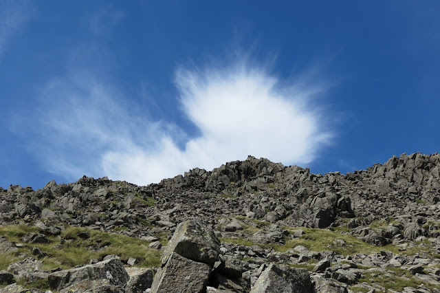 |
| The summit above us. |
Finally, we hit a fence running roughly SW to NE and the broad, stone-strewn track alongside it led us straight to the summit, a fine display of jagged, weather-sculpted rock surmounted by a trig pillar. We hung around here for a short while, waiting among the surprising number of people there to pose for the obligatory photo, and soaking up the views.
And they were excellent views too, particularly of Snowdon. For some reason, though, when I got home I found I had taken hardly any pictures of the great mountain.At the time, I had it in my head that I'd snapped plenty. I don't know what I was thinking and it was certainly an opportunity missed. I think I was so distracted by Yr Aran at the end of the South Ridge and focusing on getting photos of that shapely peak that I forgot to look at the bigger picture. North-east of Snowdon, the Glyderau and the iconic, dragon's-back ridge of Tryfan dominated the views.
 |
| Looking over to the Moelwyinion from the summit. |
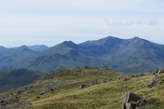 |
| Snowdon, dwarfing Yr Aran on the left. |
 |
| Yr Aran |
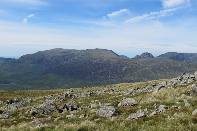 |
| Looking over to the Glyderau, with the ridge of Tryfan making an appearance. |
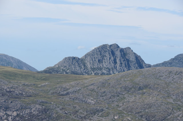 |
| Tryfan. |
Running north-east below we could see the knotty ridge descending towards Capel Curig and plenty of walkers were following this vertiginous route down the mountain. In contrast to the dramatic eastern face of Moel Siabod, the other side of the mountain slopes much more gently from the broad summit plateau. A well-established path leads down this side to the Bryn-engan Woods. It was this route we'd picked as an "easy" one back to our car but if I do the walk again, I think I'll head down the ridge. There are certainly some fine views to be had from this path, across to the High Carneddau, for one - and Snowdon too if you're climbing to the summit this way - but it is a far less-varied route than the one we took to the top. The loose pebbles and, subsequently, more cobble-like stones are sole-destroying and soul-destroying after a while too, though it might be easier going as an ascent.
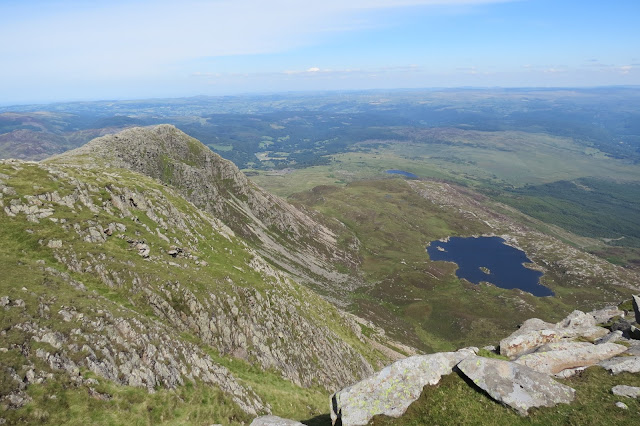 |
| The north-eastern summit ridge and Llyn-y-Foel. |
 |
| Walkers heading along the north-eastern ridge to make their descent. |
 |
| The High Carneddau. |
 |
| Our route back down to the amoeba-like Llynau Mymbyr. |
 |
| The wise, old sheep of the mountains. |
Finally we regained the forest trail we had started out on and from here it was but a short walk back to the car. Although not overly long, this proved a surprisingly tiring trip - there was 2800 feet of ascent in total (and that interminable downhill slog at the end!) but I think the heat made it feel harder work than it would have on a spring or autumn day. All that said, it was a really enjoyable introduction to Snowdonia and, as we supped our pints of shandy at the Swallow Falls Hotel, we reflected with pleasure on the variety of terrain and the wonderful views we'd enjoyed.
 |
| Back to where we started, Snowdon now basking in the afternoon sun. |
Date: August 2015
Walk length: 11.25 km
Total ascent: 837 metres


0 comments:
Post a Comment