Like our excursion to Knott End-on-Sea recently, Catlow Hill was another short walk that was planned at the last minute. The choice of location actually came from that afternoon out, inspired by the views we had seen inland, as we wandered round the lanes and salt marshes of coastal Lancashire. It was the first time either of us had been to the Forest of Bowland AONB and I really was blown away by the scenery, with huge expanses of moorland (just my type of walking country) rising up all around us.
It was far more breathtaking than the photo above suggests and I could have stood by the roadside for ages, gazing at the fells. Once I'd got back into the car, we drove on, passing through the attractive village of Slaidburn, until we reached the Cross of Greet Bridge car park, by the River Hodder.
The plan was to do an eight mile or so circular walk, taking in Bowland Knotts before crossing Catlow Hill and returning to the car. This wasn't to happen for a couple of reasons, though we started with a spring in our steps. The sun was bright, the views were amazing - and the ground beneath our feet verified with every step the description of the Forest of Bowland as a giant sponge. Immediately we left the lane, we were in a bog. We followed the old advice about avoiding the brightest green foliage and managed to hop across the worst of it, from grassy tussock to grassy tussock, eyes fixed hopefully on a piece of slightly higher ground ahead of us. All the same, Rich managed to go in through the blanket of moss up to his knee at one point - not the best way to start a walk.
What a difference two feet of height makes! After scrambling up the crumbling earth ledge onto more solid ground, we were able to survey the area we'd just traversed, with all its tell-tale patches of vivid green. It was to set a pattern for the afternoon but for the moment at least we felt a small sense of triumph and proceeded to follow the course of the Hodder west, with Catlow Fell above us to the left.
The ground proved to be slightly firmer underfoot but the land undulated beneath us and whenever we took a turn downwards water swelled ominously around our boots and we had to take to bog-hopping again.
There were some testy conversations taking place during our meander across the mires - "Why do we have to walk across bogs? Why do we always have to climb hills? etc." - but eventually we ended up at a dry stone wall that needed crossing and that became the sole topic of debate. The public footpath was clearly marked on the map (if completely invisible on the ground) but there was neither stile nor gate. That walkers had used this route was obvious from the state of the wall, which had collapsed into a heap of precariously loose slabs where one would expect a crossing point. We picked our way across, more concerned about Lotte slipping and breaking a leg than our own balance, to find ourselves facing a series of fields containing cattle. Large, hairy cattle that snarled at us from the distance, and bared their fangs... Well, that's perhaps a bit of an exaggeration, I'll admit, but it might as well be true as far as I'm concerned. I'm always chary of being in a field with cows and will avoid it if I possibly can. The fact that it was the time of year for the mothers to have their calves with them and we had the dog with us didn't add anything positive to the situation.
We decided, therefore, to re-think our walk. The land we had been on before we crossed the wall was open access so we could wander at will, provided we treated it with respect. Looking at Catlow Hill above us, we decided to retrace our steps to the lane and tackle it from there.
Having picked our way back across the boggy land, managing with hindsight to circle the largest part of the mire where the road crosses the river, we headed up the road about twenty yards.
The hillside, as you can see above, looked a good deal drier than the ground by the bridge where we'd made our false start but it turned out to be just as saturated underfoot. The best you could say about it was that there were plenty of tussocks that provided, we hoped, something solid to trust with our weight.
On one of the mossy beds I decided to test the depth of the bog beneath the surface. My walking pole was at its fullest extent, around about 5 feet long, when I pushed it through the moss and met solid ground about 4 feet below the surface. Although I was already treading carefully, I was even more wary about where I placed my feet from now on.
It doesn't show clearly in the photos but we were actually following what appeared to be a route from the lane in a curve up to the summit. It was marked by two differently-coloured parallel lines of grass that looked as though someone had driven up there, though what sort of vehicle could cope with four feet of bog or the mire that we found on the summit I'm not sure. In the event we decided to shorten the climb and take a more strenuous but shorter and drier route up the front of the hill. I always prefer a short, sharp climb to a lengthy slog on a gentler incline. It was rockier here, meaning the ground was solid and a lot less punishing on the calf muscles. There were plenty of larger rocks to sit on and take a breather while contemplating the views across the valleys below us, and I ate one of my sandwiches and rehydrated while we did this.
Refreshed from our break, we carried on upwards over the rough terrain to begin our traverse of Catlow Hill.
The summit itself was rather featureless at first sight, a wide expanse of bogs and groughs, but the higher we climbed the more we began to see what it offered in terms of views. For such a modest hill the wonderful 360° prospect we were to have from this vantage point was breathtaking.
Across Catlow Fell to the east appeared Pen-y-Ghent, our first glimpse of the Yorkshire "Three Peaks", and beside it Fountains Fell, less dramatic in outline but still an imposing presence on the horizon.
Our aim from here was to reach the intriguingly-named Ravens Castle, not quite at the highest point on Catlow Hill but just a few metres below it. A dry-stone wall running across the back of the hill like a spine indicated where to head.
Despite its name being so evocative of Gothic Romance, there was nary a rampart nor a persecuted maiden, strumming her lyre, to be seen anywhere; in fact, it's merely the top of the moor, and as damp, peaty and devoid of notable landmarks as anywhere else on the hill.
The views however, as we followed the wall to the left through a gate, were what made the climb worthwhile - for the first time that day we could all of the "Three Peaks" lined up in front of us.
To the south, Pendle Hill dominated the horizon behind Stocks Reservoir.
From here, we followed the wall north-west and then south west, where it turned a corner before becoming a fence. We were heading towards the Cross of Greet, another location on this walk the name of which promised more than it was to fulfil.
The incline to this point was a rather gentle one, descending 177 feet in just over a mile's walking. However, the bogs and sometimes quite extensive groughs that had to be crossed or circumvented meant that we frequently had to divert away from the relative straight line of the wall.
Surprisingly enough, neither of us sank more than an inch or so thanks to judicious - or lucky - choices of where to hop to next. There was a constant, cold wind roaring at us all across the top of the fell so, despite the warmth of the day, it was quite chilly up on the top and our feet were bathed in the cold waters of the bogs constantly. I wasn't aware that my summer boots had sprung a leak or two but my socks and feet were both soaked by this point - I'm guessing that whatever leaks are there are small ones and it was the constant submersion that allowed the water to gradually seep in.
Eventually, we found our way to the Cross of Greet, where there lies a large stone with a square depression cut into it. There seem to be various theories as to the provenance of both the name and the stone but little in the way of historical fact as far as I can tell. It seems clear at least, whether or not the stone held a cross or was near a cross, that this location marked the boundary point between four medieval lordships - Bowland, Burton-in-Lonsdale, Clitheroe and Hornby. I suppose where the four boundary lines of those lands met a cross would be formed on the ancient deeds or maps.
There were fine views to be had from here also, with the fells of the Lake District visible on the horizon in the north-west - though sadly it was too hazy in that direction to get any decent photos. Morecambe Bay was a little easier to focus on and I managed to get a shot of that in which you can at least just make out the bay, with Black Combe on the far side of it and Arnside Knott to the right, overlooking where the River Kent flows into the sea.
We had left the moorland and rejoined Lythe Fell Road at the Cross of Greet and from here it was a straightforward, 2 mile walk back to the car along the lane.
It was something of a relief to be on solid ground and the further down into the valley we got the less we felt of the prevailing, cold wind - even my sodden boots began to feel a little warmer and more comfortable.
The lane followed the course of the River Hodder downwards and, despite the rock outcrops on the side of Catlow Hill, it was the flanks of Lamb Hill Fell opposite that offered some of the most rewarding scenery on the the way down. The curiously-named Far Costy Clough (our car was parked by Near Costy Clough) was particularly impressive. The rolling slopes of the moors belie their true size and height but the trees growing on the sides of this clough gave a more real sense of the all-too-often underrated majesty of these landscapes. As there was a footpath along the river and up the valley, we marked this down as a likely route up onto the fell and to the summit of White Hill in the future.
This little fella stared at us, without twitching so much as a nostril, for around ten minutes as we approached. Once we passed he walked down to the roadside and continued to stare at us until we were out of sight, as though he wanted to make sure we were definitely off his patch.
This wasn't the walk we had intended to do and, if I'm honest, I'd say Catlow Hill doesn't have enough merit in itself to make it the focal point of a day out - the views were wonderful, it's true, but I'd only do it again as part of a longer walk as we had originally intended to do.
Date: June 2015
Walk length: 8 km
Total ascent: 277 metres
 |
| The Forest of Bowland |
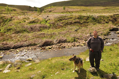 |
| Lotte and Rich by the River Hoddder |
The plan was to do an eight mile or so circular walk, taking in Bowland Knotts before crossing Catlow Hill and returning to the car. This wasn't to happen for a couple of reasons, though we started with a spring in our steps. The sun was bright, the views were amazing - and the ground beneath our feet verified with every step the description of the Forest of Bowland as a giant sponge. Immediately we left the lane, we were in a bog. We followed the old advice about avoiding the brightest green foliage and managed to hop across the worst of it, from grassy tussock to grassy tussock, eyes fixed hopefully on a piece of slightly higher ground ahead of us. All the same, Rich managed to go in through the blanket of moss up to his knee at one point - not the best way to start a walk.
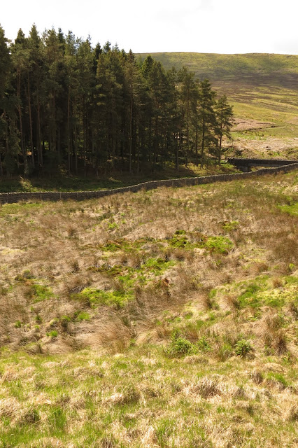 |
| Looking back down at the first bog of the afternoon. |
The ground proved to be slightly firmer underfoot but the land undulated beneath us and whenever we took a turn downwards water swelled ominously around our boots and we had to take to bog-hopping again.
There were some testy conversations taking place during our meander across the mires - "Why do we have to walk across bogs? Why do we always have to climb hills? etc." - but eventually we ended up at a dry stone wall that needed crossing and that became the sole topic of debate. The public footpath was clearly marked on the map (if completely invisible on the ground) but there was neither stile nor gate. That walkers had used this route was obvious from the state of the wall, which had collapsed into a heap of precariously loose slabs where one would expect a crossing point. We picked our way across, more concerned about Lotte slipping and breaking a leg than our own balance, to find ourselves facing a series of fields containing cattle. Large, hairy cattle that snarled at us from the distance, and bared their fangs... Well, that's perhaps a bit of an exaggeration, I'll admit, but it might as well be true as far as I'm concerned. I'm always chary of being in a field with cows and will avoid it if I possibly can. The fact that it was the time of year for the mothers to have their calves with them and we had the dog with us didn't add anything positive to the situation.
We decided, therefore, to re-think our walk. The land we had been on before we crossed the wall was open access so we could wander at will, provided we treated it with respect. Looking at Catlow Hill above us, we decided to retrace our steps to the lane and tackle it from there.
 |
| Catlow Hill |
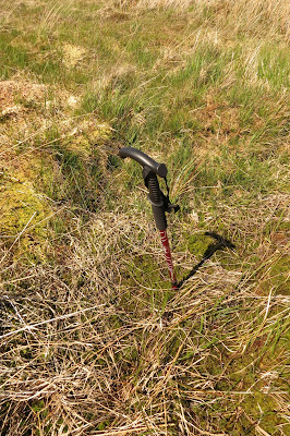 |
| Testing the ground with my walking pole. |
The hillside, as you can see above, looked a good deal drier than the ground by the bridge where we'd made our false start but it turned out to be just as saturated underfoot. The best you could say about it was that there were plenty of tussocks that provided, we hoped, something solid to trust with our weight.
On one of the mossy beds I decided to test the depth of the bog beneath the surface. My walking pole was at its fullest extent, around about 5 feet long, when I pushed it through the moss and met solid ground about 4 feet below the surface. Although I was already treading carefully, I was even more wary about where I placed my feet from now on.
It doesn't show clearly in the photos but we were actually following what appeared to be a route from the lane in a curve up to the summit. It was marked by two differently-coloured parallel lines of grass that looked as though someone had driven up there, though what sort of vehicle could cope with four feet of bog or the mire that we found on the summit I'm not sure. In the event we decided to shorten the climb and take a more strenuous but shorter and drier route up the front of the hill. I always prefer a short, sharp climb to a lengthy slog on a gentler incline. It was rockier here, meaning the ground was solid and a lot less punishing on the calf muscles. There were plenty of larger rocks to sit on and take a breather while contemplating the views across the valleys below us, and I ate one of my sandwiches and rehydrated while we did this.
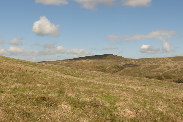 |
| Bowland Knotts to the east. |
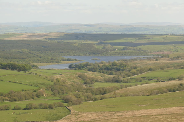 |
| Looking south to Stocks Reservoir. |
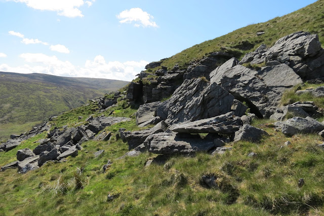 |
| Looking west from our resting spot to Lamb Hill Fell. |
 |
| Pen-y-Ghent (l) and Fountains Fell (r). |
The summit itself was rather featureless at first sight, a wide expanse of bogs and groughs, but the higher we climbed the more we began to see what it offered in terms of views. For such a modest hill the wonderful 360° prospect we were to have from this vantage point was breathtaking.
Across Catlow Fell to the east appeared Pen-y-Ghent, our first glimpse of the Yorkshire "Three Peaks", and beside it Fountains Fell, less dramatic in outline but still an imposing presence on the horizon.
Our aim from here was to reach the intriguingly-named Ravens Castle, not quite at the highest point on Catlow Hill but just a few metres below it. A dry-stone wall running across the back of the hill like a spine indicated where to head.
 |
| Ravens Castle, dead ahead. |
The views however, as we followed the wall to the left through a gate, were what made the climb worthwhile - for the first time that day we could all of the "Three Peaks" lined up in front of us.
 |
| From l to r: Whernside, Ingleborough with its plateau at the summit, and Pen-y-Ghent. |
 |
| Whernside |
 |
| Ingleborough |
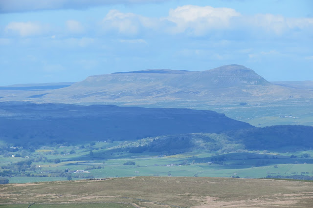 |
| Pen-y-Ghent |
 |
| Pendle Hill |
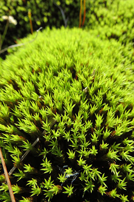 |
| Sphagnum moss on top of Catlow Hill |
The incline to this point was a rather gentle one, descending 177 feet in just over a mile's walking. However, the bogs and sometimes quite extensive groughs that had to be crossed or circumvented meant that we frequently had to divert away from the relative straight line of the wall.
Surprisingly enough, neither of us sank more than an inch or so thanks to judicious - or lucky - choices of where to hop to next. There was a constant, cold wind roaring at us all across the top of the fell so, despite the warmth of the day, it was quite chilly up on the top and our feet were bathed in the cold waters of the bogs constantly. I wasn't aware that my summer boots had sprung a leak or two but my socks and feet were both soaked by this point - I'm guessing that whatever leaks are there are small ones and it was the constant submersion that allowed the water to gradually seep in.
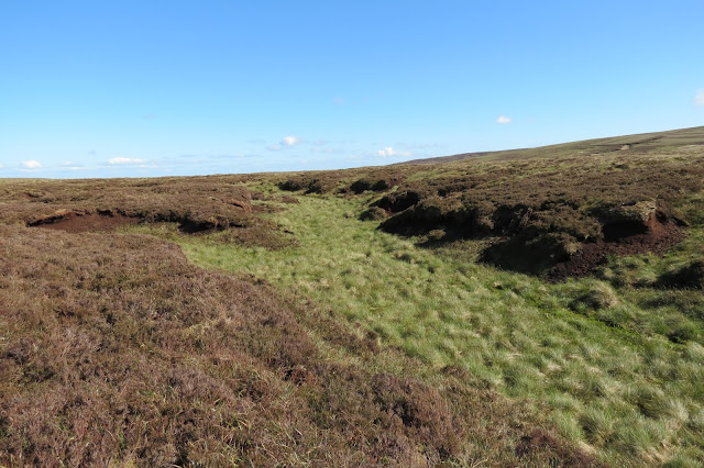 |
| A characteristic view of Catlow Hill's summit. |
 |
| Time to venture away from the "path" again. |
 |
| Cross of Greet. |
There were fine views to be had from here also, with the fells of the Lake District visible on the horizon in the north-west - though sadly it was too hazy in that direction to get any decent photos. Morecambe Bay was a little easier to focus on and I managed to get a shot of that in which you can at least just make out the bay, with Black Combe on the far side of it and Arnside Knott to the right, overlooking where the River Kent flows into the sea.
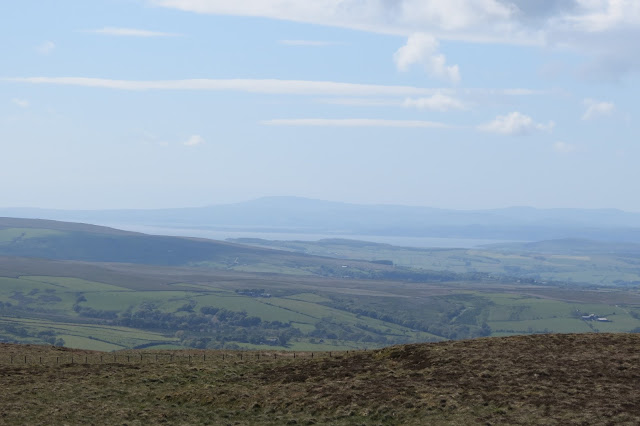 |
| Looking across to Morecambe Bay |
We had left the moorland and rejoined Lythe Fell Road at the Cross of Greet and from here it was a straightforward, 2 mile walk back to the car along the lane.
It was something of a relief to be on solid ground and the further down into the valley we got the less we felt of the prevailing, cold wind - even my sodden boots began to feel a little warmer and more comfortable.
The lane followed the course of the River Hodder downwards and, despite the rock outcrops on the side of Catlow Hill, it was the flanks of Lamb Hill Fell opposite that offered some of the most rewarding scenery on the the way down. The curiously-named Far Costy Clough (our car was parked by Near Costy Clough) was particularly impressive. The rolling slopes of the moors belie their true size and height but the trees growing on the sides of this clough gave a more real sense of the all-too-often underrated majesty of these landscapes. As there was a footpath along the river and up the valley, we marked this down as a likely route up onto the fell and to the summit of White Hill in the future.
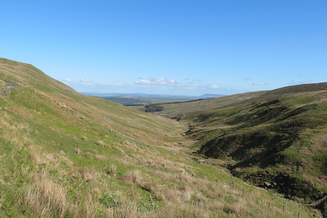 |
| The course of the River Hodder down the valley - the small plantation at the end is our destination |
 |
| Far Costy Clough |
This little fella stared at us, without twitching so much as a nostril, for around ten minutes as we approached. Once we passed he walked down to the roadside and continued to stare at us until we were out of sight, as though he wanted to make sure we were definitely off his patch.
This wasn't the walk we had intended to do and, if I'm honest, I'd say Catlow Hill doesn't have enough merit in itself to make it the focal point of a day out - the views were wonderful, it's true, but I'd only do it again as part of a longer walk as we had originally intended to do.
Date: June 2015
Walk length: 8 km
Total ascent: 277 metres


0 comments:
Post a Comment